Němčičky (Brno-Country District)
Němčičky | |
|---|---|
_-_kaple_Narozen%C3%AD_Panny_Marie_obr1.jpg) Chapel of the Nativity of the Virgin Mary | |
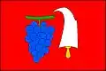 Flag 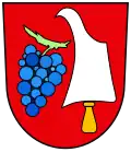 Coat of arms | |
 Němčičky Location in the Czech Republic | |
| Coordinates: 49°3′1″N 16°30′2″E / 49.05028°N 16.50056°E | |
| Country | |
| Region | South Moravian |
| District | Brno-Country |
| First mentioned | 1354 |
| Area | |
• Total | 4.58 km2 (1.77 sq mi) |
| Elevation | 190 m (620 ft) |
| Population (2025-01-01)[1] | |
• Total | 343 |
| • Density | 75/km2 (190/sq mi) |
| Time zone | UTC+1 (CET) |
| • Summer (DST) | UTC+2 (CEST) |
| Postal code | 664 66 |
| Website | www |
Němčičky is a municipality and village in Brno-Country District in the South Moravian Region of the Czech Republic. It has about 300 inhabitants.
Němčičky lies approximately 19 kilometres (12 mi) south-west of Brno and 190 km (120 mi) south-east of Prague.
Demographics
| Year | Pop. | ±% |
|---|---|---|
| 1869 | 306 | — |
| 1880 | 318 | +3.9% |
| 1890 | 341 | +7.2% |
| 1900 | 312 | −8.5% |
| 1910 | 315 | +1.0% |
| 1921 | 321 | +1.9% |
| 1930 | 333 | +3.7% |
| 1950 | 259 | −22.2% |
| 1961 | 258 | −0.4% |
| 1970 | 238 | −7.8% |
| 1980 | 251 | +5.5% |
| 1991 | 251 | +0.0% |
| 2001 | 276 | +10.0% |
| 2011 | 324 | +17.4% |
| 2021 | 314 | −3.1% |
| Source: Censuses[2][3] | ||
References
- ^ "Population of Municipalities – 1 January 2025". Czech Statistical Office. 2025-05-16.
- ^ "Historický lexikon obcí České republiky 1869–2011" (in Czech). Czech Statistical Office. 2015-12-21.
- ^ "Population Census 2021: Population by sex". Public Database. Czech Statistical Office. 2021-03-27.
External links
Wikimedia Commons has media related to Němčičky (Brno-Country District).