Gouarec
Gouarec
Gwareg | |
|---|---|
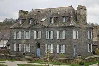 The town hall of Gouarec | |
.svg.png) Coat of arms | |
Location of Gouarec | |
 Gouarec  Gouarec | |
| Coordinates: 48°13′38″N 3°10′46″W / 48.2272°N 3.1794°W | |
| Country | France |
| Region | Brittany |
| Department | Côtes-d'Armor |
| Arrondissement | Guingamp |
| Canton | Rostrenen |
| Intercommunality | Kreiz-Breizh |
| Government | |
| • Mayor (2020–2026) | Jérôme Lejart[1] |
Area 1 | 6.41 km2 (2.47 sq mi) |
| Population (2022)[2] | 912 |
| • Density | 140/km2 (370/sq mi) |
| Time zone | UTC+01:00 (CET) |
| • Summer (DST) | UTC+02:00 (CEST) |
| INSEE/Postal code | 22064 /22570 |
| Elevation | 127–210 m (417–689 ft) |
| 1 French Land Register data, which excludes lakes, ponds, glaciers > 1 km2 (0.386 sq mi or 247 acres) and river estuaries. | |
Gouarec (French pronunciation: [ɡwaʁɛk]; Breton: Gwareg) is a commune in the Côtes-d'Armor department of Brittany in northwestern France.
Population
Inhabitants of Gouarec are called gouarécains in French.
See also
References
- ^ "Répertoire national des élus: les maires". data.gouv.fr, Plateforme ouverte des données publiques françaises (in French). 9 August 2021.
- ^ "Populations de référence 2022" (in French). The National Institute of Statistics and Economic Studies. 19 December 2024.
External links
Wikimedia Commons has media related to Gouarec.
- Base Mérimée: Search for heritage in the commune, Ministère français de la Culture. (in French)
- Biking along the Nantes-Brest canal