Trémorel
Trémorel
Tremorae | |
|---|---|
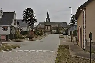 The centre of Trémorel | |
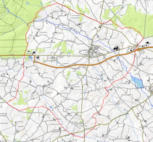
Location of Trémorel | |
 Trémorel  Trémorel | |
| Coordinates: 48°12′00″N 2°17′16″W / 48.2°N 2.2878°W | |
| Country | France |
| Region | Brittany |
| Department | Côtes-d'Armor |
| Arrondissement | Saint-Brieuc |
| Canton | Broons |
| Government | |
| • Mayor (2020–2026) | Michel Rouvrais[1] |
Area 1 | 33.76 km2 (13.03 sq mi) |
| Population (2022)[2] | 1,154 |
| • Density | 34/km2 (89/sq mi) |
| Time zone | UTC+01:00 (CET) |
| • Summer (DST) | UTC+02:00 (CEST) |
| INSEE/Postal code | 22371 /22230 |
| Elevation | 78–144 m (256–472 ft) |
| 1 French Land Register data, which excludes lakes, ponds, glaciers > 1 km2 (0.386 sq mi or 247 acres) and river estuaries. | |
Trémorel (French pronunciation: [tʁemɔʁɛl]; Breton: Tremorae; Gallo: Termorae) is a commune in the Côtes-d'Armor department of Brittany in northwestern France.
Geography
The river Meu flows southeast through the northern part of the commune.
Map
Population
|
| ||||||||||||||||||||||||||||||||||||||||||||||||||||||||||||||||||||||||||||||||||||||||||||||||||||||||||||||||||
| Source: EHESS[3] and INSEE (1968-2020)[4] | |||||||||||||||||||||||||||||||||||||||||||||||||||||||||||||||||||||||||||||||||||||||||||||||||||||||||||||||||||
Inhabitants of Trémorel are called trémorelois in French.
See also
References
- ^ "Répertoire national des élus: les maires". data.gouv.fr, Plateforme ouverte des données publiques françaises (in French). 2 December 2020.
- ^ "Populations de référence 2022" (in French). The National Institute of Statistics and Economic Studies. 19 December 2024.
- ^ Des villages de Cassini aux communes d'aujourd'hui: Commune data sheet Trémorel, EHESS (in French).
- ^ Population en historique depuis 1968, INSEE
External links
Wikimedia Commons has media related to Trémorel.
- Official website (in French)