Lanrodec
Lanrodec
Lanrodeg | |
|---|---|
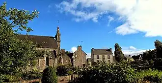 The Rue des Écoliers in Lanrodec | |
Location of Lanrodec | |
 Lanrodec  Lanrodec | |
| Coordinates: 48°31′01″N 3°01′47″W / 48.5169°N 3.0297°W | |
| Country | France |
| Region | Brittany |
| Department | Côtes-d'Armor |
| Arrondissement | Guingamp |
| Canton | Plélo |
| Government | |
| • Mayor (2024–2026) | Alain Ollivier-Henry[1] |
Area 1 | 31.92 km2 (12.32 sq mi) |
| Population (2022)[2] | 1,380 |
| • Density | 43/km2 (110/sq mi) |
| Time zone | UTC+01:00 (CET) |
| • Summer (DST) | UTC+02:00 (CEST) |
| INSEE/Postal code | 22116 /22170 |
| Elevation | 132–208 m (433–682 ft) |
| 1 French Land Register data, which excludes lakes, ponds, glaciers > 1 km2 (0.386 sq mi or 247 acres) and river estuaries. | |
Lanrodec (French pronunciation: [lɑ̃ʁɔdɛk]; Breton: Lanrodeg) is a commune in the Côtes-d'Armor department of Brittany in northwestern France.
Population
| Year | Pop. | ±% |
|---|---|---|
| 1962 | 755 | — |
| 1968 | 844 | +11.8% |
| 1975 | 724 | −14.2% |
| 1982 | 785 | +8.4% |
| 1990 | 801 | +2.0% |
| 1999 | 843 | +5.2% |
| 2008 | 1,050 | +24.6% |
Inhabitants of Lanrodec are called lanrodéciens in French.
See also
References
- ^ "Répertoire national des élus: les maires" (in French). data.gouv.fr, Plateforme ouverte des données publiques françaises. 12 March 2025.
- ^ "Populations de référence 2022" (in French). The National Institute of Statistics and Economic Studies. 19 December 2024.
External links
Wikimedia Commons has media related to Lanrodec.
- Base Mérimée: Search for heritage in the commune, Ministère français de la Culture. (in French)