Křenovy
Křenovy | |
|---|---|
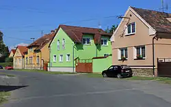 Centre of Křenovy | |
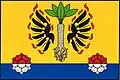 Flag 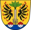 Coat of arms | |
 Křenovy Location in the Czech Republic | |
| Coordinates: 49°32′21″N 13°1′18″E / 49.53917°N 13.02167°E | |
| Country | |
| Region | Plzeň |
| District | Domažlice |
| First mentioned | 1379 |
| Area | |
• Total | 3.13 km2 (1.21 sq mi) |
| Elevation | 368 m (1,207 ft) |
| Population (2025-01-01)[1] | |
• Total | 148 |
| • Density | 47/km2 (120/sq mi) |
| Time zone | UTC+1 (CET) |
| • Summer (DST) | UTC+2 (CEST) |
| Postal code | 345 61 |
| Website | www |
Křenovy is a municipality and village in Domažlice District in the Plzeň Region of the Czech Republic. It has about 100 inhabitants.
Křenovy lies approximately 13 kilometres (8 mi) north-east of Domažlice, 35 km (22 mi) south-west of Plzeň, and 118 km (73 mi) south-west of Prague.
History
The first written mention of Křenovy is from 1379.[2]
Demographics
| Year | Pop. | ±% |
|---|---|---|
| 1869 | 203 | — |
| 1880 | 203 | +0.0% |
| 1890 | 228 | +12.3% |
| 1900 | 264 | +15.8% |
| 1910 | 244 | −7.6% |
| 1921 | 203 | −16.8% |
| 1930 | 225 | +10.8% |
| 1950 | 176 | −21.8% |
| 1961 | 188 | +6.8% |
| 1970 | 180 | −4.3% |
| 1980 | 186 | +3.3% |
| 1991 | 149 | −19.9% |
| 2001 | 150 | +0.7% |
| 2011 | 148 | −1.3% |
| 2021 | 137 | −7.4% |
| Source: Censuses[3][4] | ||
References
- ^ "Population of Municipalities – 1 January 2025". Czech Statistical Office. 2025-05-16.
- ^ "Historie" (in Czech). Obec Křenovy. Retrieved 2022-07-09.
- ^ "Historický lexikon obcí České republiky 1869–2011" (in Czech). Czech Statistical Office. 2015-12-21.
- ^ "Population Census 2021: Population by sex". Public Database. Czech Statistical Office. 2021-03-27.
External links
Wikimedia Commons has media related to Křenovy.