Spáňov
Spáňov | |
|---|---|
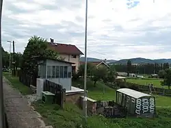 Train stop | |
 Flag  Coat of arms | |
 Spáňov Location in the Czech Republic | |
| Coordinates: 49°24′53″N 12°59′14″E / 49.41472°N 12.98722°E | |
| Country | |
| Region | Plzeň |
| District | Domažlice |
| First mentioned | 1372 |
| Area | |
• Total | 3.27 km2 (1.26 sq mi) |
| Elevation | 435 m (1,427 ft) |
| Population (2025-01-01)[1] | |
• Total | 218 |
| • Density | 67/km2 (170/sq mi) |
| Time zone | UTC+1 (CET) |
| • Summer (DST) | UTC+2 (CEST) |
| Postal code | 344 01 |
| Website | www |
Spáňov is a municipality and village in Domažlice District in the Plzeň Region of the Czech Republic. It has about 200 inhabitants.
Spáňov lies approximately 5 kilometres (3 mi) south-east of Domažlice, 47 km (29 mi) south-west of Plzeň, and 128 km (80 mi) south-west of Prague.
Demographics
| Year | Pop. | ±% |
|---|---|---|
| 1869 | 238 | — |
| 1880 | 199 | −16.4% |
| 1890 | 176 | −11.6% |
| 1900 | 209 | +18.8% |
| 1910 | 230 | +10.0% |
| 1921 | 203 | −11.7% |
| 1930 | 208 | +2.5% |
| 1950 | 177 | −14.9% |
| 1961 | 173 | −2.3% |
| 1970 | 159 | −8.1% |
| 1980 | 173 | +8.8% |
| 1991 | 174 | +0.6% |
| 2001 | 187 | +7.5% |
| 2011 | 180 | −3.7% |
| 2021 | 211 | +17.2% |
| Source: Censuses[2][3] | ||
References
- ^ "Population of Municipalities – 1 January 2025". Czech Statistical Office. 2025-05-16.
- ^ "Historický lexikon obcí České republiky 1869–2011" (in Czech). Czech Statistical Office. 2015-12-21.
- ^ "Population Census 2021: Population by sex". Public Database. Czech Statistical Office. 2021-03-27.
External links
Wikimedia Commons has media related to Spáňov.