Mnichov (Domažlice District)
Mnichov | |
|---|---|
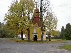 Chapel of the Holy Trinity | |
 Mnichov Location in the Czech Republic | |
| Coordinates: 49°29′49″N 12°45′52″E / 49.49694°N 12.76444°E | |
| Country | |
| Region | Plzeň |
| District | Domažlice |
| First mentioned | 1550 |
| Area | |
• Total | 14.25 km2 (5.50 sq mi) |
| Elevation | 472 m (1,549 ft) |
| Population (2025-01-01)[1] | |
• Total | 218 |
| • Density | 15/km2 (40/sq mi) |
| Time zone | UTC+1 (CET) |
| • Summer (DST) | UTC+2 (CEST) |
| Postal code | 345 22 |
| Website | obec-mnichov |
Mnichov is a municipality and village in Domažlice District in the Plzeň Region of the Czech Republic. It has about 200 inhabitants.
Mnichov lies approximately 14 kilometres (9 mi) north-west of Domažlice, 53 km (33 mi) south-west of Plzeň, and 137 km (85 mi) south-west of Prague.
Administrative division
Mnichov consists of three municipal parts (in brackets population according to the 2021 census):[2]
- Mnichov (143)
- Pivoň (47)
- Vranov (25)
Demographics
| Year | Pop. | ±% |
|---|---|---|
| 1869 | 1,125 | — |
| 1880 | 1,123 | −0.2% |
| 1890 | 1,096 | −2.4% |
| 1900 | 1,090 | −0.5% |
| 1910 | 1,148 | +5.3% |
| 1921 | 1,152 | +0.3% |
| 1930 | 1,019 | −11.5% |
| 1950 | 422 | −58.6% |
| 1961 | 320 | −24.2% |
| 1970 | 330 | +3.1% |
| 1980 | 296 | −10.3% |
| 1991 | 270 | −8.8% |
| 2001 | 243 | −10.0% |
| 2011 | 232 | −4.5% |
| 2021 | 215 | −7.3% |
| Source: Censuses[3][4] | ||
References
- ^ "Population of Municipalities – 1 January 2025". Czech Statistical Office. 2025-05-16.
- ^ "Public Census 2021 – basic data". Public Database (in Czech). Czech Statistical Office. 2022.
- ^ "Historický lexikon obcí České republiky 1869–2011" (in Czech). Czech Statistical Office. 2015-12-21.
- ^ "Population Census 2021: Population by sex". Public Database. Czech Statistical Office. 2021-03-27.
External links
Wikimedia Commons has media related to Mnichov (Domažlice District).