Močerady
Močerady | |
|---|---|
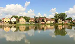 Pond in the centre of Močerady | |
 Močerady Location in the Czech Republic | |
| Coordinates: 49°31′3″N 13°4′28″E / 49.51750°N 13.07444°E | |
| Country | |
| Region | Plzeň |
| District | Domažlice |
| First mentioned | 1115 |
| Area | |
• Total | 6.67 km2 (2.58 sq mi) |
| Elevation | 428 m (1,404 ft) |
| Population (2025-01-01)[1] | |
• Total | 78 |
| • Density | 12/km2 (30/sq mi) |
| Time zone | UTC+1 (CET) |
| • Summer (DST) | UTC+2 (CEST) |
| Postal code | 345 61 |
| Website | www |
Močerady is a municipality and village in Domažlice District in the Plzeň Region of the Czech Republic. It has about 80 inhabitants.
Močerady lies approximately 13 kilometres (8 mi) north-east of Domažlice, 35 km (22 mi) south-west of Plzeň, and 117 km (73 mi) south-west of Prague.
Administrative division
Močerady consists of two municipal parts (in brackets population according to the 2021 census):[2]
- Močerady (51)
- Nové Dvory (5)
Demographics
| Year | Pop. | ±% |
|---|---|---|
| 1869 | 219 | — |
| 1880 | 270 | +23.3% |
| 1890 | 258 | −4.4% |
| 1900 | 290 | +12.4% |
| 1910 | 345 | +19.0% |
| 1921 | 337 | −2.3% |
| 1930 | 292 | −13.4% |
| 1950 | 188 | −35.6% |
| 1961 | 168 | −10.6% |
| 1970 | 131 | −22.0% |
| 1980 | 114 | −13.0% |
| 1991 | 90 | −21.1% |
| 2001 | 80 | −11.1% |
| 2011 | 60 | −25.0% |
| 2021 | 56 | −6.7% |
| Source: Censuses[3][4] | ||
References
- ^ "Population of Municipalities – 1 January 2025". Czech Statistical Office. 2025-05-16.
- ^ "Public Census 2021 – basic data". Public Database (in Czech). Czech Statistical Office. 2022.
- ^ "Historický lexikon obcí České republiky 1869–2011" (in Czech). Czech Statistical Office. 2015-12-21.
- ^ "Population Census 2021: Population by sex". Public Database. Czech Statistical Office. 2021-03-27.
External links
Wikimedia Commons has media related to Močerady.