Meljac
Meljac | |
|---|---|
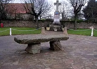 Dolmen | |
 Coat of arms | |
Location of Meljac | |
 Meljac  Meljac | |
| Coordinates: 44°08′22″N 2°26′10″E / 44.1394°N 2.4361°E | |
| Country | France |
| Region | Occitania |
| Department | Aveyron |
| Arrondissement | Villefranche-de-Rouergue |
| Canton | Ceor-Ségala |
| Government | |
| • Mayor (2020–2026) | Pierre Bousquet[1] |
Area 1 | 9.54 km2 (3.68 sq mi) |
| Population (2022)[2] | 135 |
| • Density | 14/km2 (37/sq mi) |
| Time zone | UTC+01:00 (CET) |
| • Summer (DST) | UTC+02:00 (CEST) |
| INSEE/Postal code | 12144 /12120 |
| Elevation | 350–608 m (1,148–1,995 ft) (avg. 583 m or 1,913 ft) |
| 1 French Land Register data, which excludes lakes, ponds, glaciers > 1 km2 (0.386 sq mi or 247 acres) and river estuaries. | |
Meljac (French pronunciation: [mɛlʒak]) is a commune in the Aveyron department in southern France.
Geography
The river Céor forms all of the commune's northern border.
Population
| Year | Pop. | ±% |
|---|---|---|
| 1962 | 234 | — |
| 1968 | 281 | +20.1% |
| 1975 | 250 | −11.0% |
| 1982 | 233 | −6.8% |
| 1990 | 217 | −6.9% |
| 1999 | 155 | −28.6% |
| 2008 | 140 | −9.7% |
See also
References
- ^ "Répertoire national des élus: les maires" (in French). data.gouv.fr, Plateforme ouverte des données publiques françaises. 13 September 2022.
- ^ "Populations de référence 2022" (in French). The National Institute of Statistics and Economic Studies. 19 December 2024.
Wikimedia Commons has media related to Meljac.