Rignac, Aveyron
Rignac | |
|---|---|
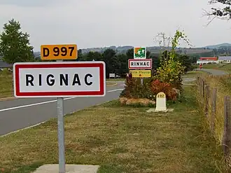 The road into Rignac | |
.svg.png) Coat of arms | |
Location of Rignac | |
 Rignac  Rignac | |
| Coordinates: 44°24′36″N 2°17′25″E / 44.41°N 2.2903°E | |
| Country | France |
| Region | Occitania |
| Department | Aveyron |
| Arrondissement | Villefranche-de-Rouergue |
| Canton | Enne et Alzou |
| Intercommunality | Pays Rignacois |
| Government | |
| • Mayor (2020–2026) | Jean-Marc Calvet[1] |
Area 1 | 33.35 km2 (12.88 sq mi) |
| Population (2022)[2] | 2,019 |
| • Density | 61/km2 (160/sq mi) |
| Time zone | UTC+01:00 (CET) |
| • Summer (DST) | UTC+02:00 (CEST) |
| INSEE/Postal code | 12199 /12390 |
| Elevation | 390–684 m (1,280–2,244 ft) (avg. 505 m or 1,657 ft) |
| 1 French Land Register data, which excludes lakes, ponds, glaciers > 1 km2 (0.386 sq mi or 247 acres) and river estuaries. | |
Rignac (French pronunciation: [ʁiɲak]; Languedocien: Rinhac) is a commune in the Aveyron department in southern France.
Population
| Year | Pop. | ±% |
|---|---|---|
| 1962 | 1,541 | — |
| 1968 | 1,675 | +8.7% |
| 1975 | 1,571 | −6.2% |
| 1982 | 1,585 | +0.9% |
| 1990 | 1,668 | +5.2% |
| 1999 | 1,658 | −0.6% |
| 2008 | 1,889 | +13.9% |
See also
References
- ^ "Répertoire national des élus: les maires". data.gouv.fr, Plateforme ouverte des données publiques françaises (in French). 2 December 2020.
- ^ "Populations de référence 2022" (in French). The National Institute of Statistics and Economic Studies. 19 December 2024.
Wikimedia Commons has media related to Rignac (Aveyron).