Saint-Michel, Charente
Saint-Michel | |
|---|---|
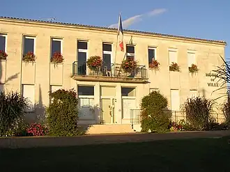 Town hall | |
.svg.png) Coat of arms | |
Location of Saint-Michel | |
 Saint-Michel  Saint-Michel | |
| Coordinates: 45°38′34″N 0°06′26″E / 45.6428°N 0.1072°E | |
| Country | France |
| Region | Nouvelle-Aquitaine |
| Department | Charente |
| Arrondissement | Angoulême |
| Canton | La Couronne |
| Intercommunality | Grand Angoulême |
| Government | |
| • Mayor (2020–2026) | Fabienne Godichaud[1] |
Area 1 | 2.46 km2 (0.95 sq mi) |
| Population (2022)[2] | 3,220 |
| • Density | 1,300/km2 (3,400/sq mi) |
| Time zone | UTC+01:00 (CET) |
| • Summer (DST) | UTC+02:00 (CEST) |
| INSEE/Postal code | 16341 /16470 |
| Elevation | 25–62 m (82–203 ft) (avg. 33 m or 108 ft) |
| 1 French Land Register data, which excludes lakes, ponds, glaciers > 1 km2 (0.386 sq mi or 247 acres) and river estuaries. | |
Saint-Michel (French pronunciation: [sɛ̃ miʃɛl] ⓘ) is a commune in the Charente department in southwestern France.
Population
|
| |||||||||||||||||||||||||||||||||||||||||||||||||||||||||||||||||||||||||||||||||||||||||||||||||||||||||||||||
| Source: EHESS[3] and INSEE (1968-2017)[4] | ||||||||||||||||||||||||||||||||||||||||||||||||||||||||||||||||||||||||||||||||||||||||||||||||||||||||||||||||
See also
References
- ^ "Répertoire national des élus: les maires". data.gouv.fr, Plateforme ouverte des données publiques françaises (in French). 2 December 2020.
- ^ "Populations de référence 2022" (in French). The National Institute of Statistics and Economic Studies. 19 December 2024.
- ^ Des villages de Cassini aux communes d'aujourd'hui: Commune data sheet Saint-Michel, EHESS (in French).
- ^ Population en historique depuis 1968, INSEE
Wikimedia Commons has media related to Saint-Michel (Charente).