Talais
Talais | |
|---|---|
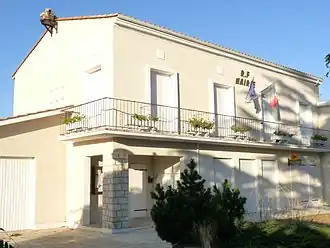 The town hall in Talais | |
Location of Talais | |
 Talais  Talais | |
| Coordinates: 45°28′23″N 1°03′23″W / 45.4731°N 1.0564°W | |
| Country | France |
| Region | Nouvelle-Aquitaine |
| Department | Gironde |
| Arrondissement | Lesparre-Médoc |
| Canton | Le Nord-Médoc |
| Government | |
| • Mayor (2020–2026) | Franck Laporte[1] |
Area 1 | 15.27 km2 (5.90 sq mi) |
| Population (2022)[2] | 756 |
| • Density | 50/km2 (130/sq mi) |
| Time zone | UTC+01:00 (CET) |
| • Summer (DST) | UTC+02:00 (CEST) |
| INSEE/Postal code | 33521 /33590 |
| Elevation | 0–16 m (0–52 ft) (avg. 4 m or 13 ft) |
| 1 French Land Register data, which excludes lakes, ponds, glaciers > 1 km2 (0.386 sq mi or 247 acres) and river estuaries. | |
Talais (French pronunciation: [talɛ]) is a commune in the Gironde department in Nouvelle-Aquitaine in southwestern France.
Population
| Year | Pop. | ±% |
|---|---|---|
| 1962 | 541 | — |
| 1968 | 549 | +1.5% |
| 1975 | 566 | +3.1% |
| 1982 | 542 | −4.2% |
| 1990 | 599 | +10.5% |
| 1999 | 547 | −8.7% |
| 2008 | 639 | +16.8% |
See also
References
- ^ "Répertoire national des élus: les maires". data.gouv.fr, Plateforme ouverte des données publiques françaises (in French). 2 December 2020.
- ^ "Populations de référence 2022" (in French). The National Institute of Statistics and Economic Studies. 19 December 2024.
Wikimedia Commons has media related to Talais.