Authou
Authou | |
|---|---|
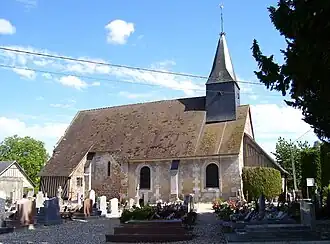 Church of Saint-Aubin | |
Location of Authou | |
 Authou  Authou | |
| Coordinates: 49°13′55″N 0°41′37″E / 49.2319°N 0.6936°E | |
| Country | France |
| Region | Normandy |
| Department | Eure |
| Arrondissement | Bernay |
| Canton | Pont-Audemer |
| Intercommunality | CC Pont-Audemer Val de Risle |
| Government | |
| • Mayor (2024–2026) | Bruno Lechaptois[1] |
Area 1 | 2.96 km2 (1.14 sq mi) |
| Population (2022)[2] | 333 |
| • Density | 110/km2 (290/sq mi) |
| Time zone | UTC+01:00 (CET) |
| • Summer (DST) | UTC+02:00 (CEST) |
| INSEE/Postal code | 27028 /27290 |
| Elevation | 43–120 m (141–394 ft) (avg. 45 m or 148 ft) |
| 1 French Land Register data, which excludes lakes, ponds, glaciers > 1 km2 (0.386 sq mi or 247 acres) and river estuaries. | |
Authou (French pronunciation: [otu]) is a commune in the Eure department in Normandy in northern France.
Geography
The commune along with another 69 communes shares part of a 4,747 hectare, Natura 2000 conservation area, called Risle, Guiel, Charentonne.[3]
Population
| Year | Pop. | ±% |
|---|---|---|
| 1962 | 343 | — |
| 1968 | 362 | +5.5% |
| 1975 | 334 | −7.7% |
| 1982 | 283 | −15.3% |
| 1990 | 306 | +8.1% |
| 1999 | 321 | +4.9% |
| 2008 | 345 | +7.5% |
| 2015 | 337 | −2.3% |
See also
References
- ^ "Répertoire national des élus: les maires" (in French). data.gouv.fr, Plateforme ouverte des données publiques françaises. 12 March 2025.
- ^ "Populations de référence 2022" (in French). The National Institute of Statistics and Economic Studies. 19 December 2024.
- ^ "INPN - FSD Natura 2000 - FR2300150 - Risle, Guiel, Charentonne - Description".
Wikimedia Commons has media related to Authou.