Saint-Marcel, Eure
Saint-Marcel | |
|---|---|
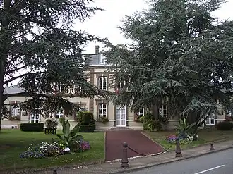 The town hall in Saint-Marcel | |
.svg.png) Coat of arms | |
Location of Saint-Marcel | |
 Saint-Marcel  Saint-Marcel | |
| Coordinates: 49°05′49″N 1°26′47″E / 49.0969°N 1.4464°E | |
| Country | France |
| Region | Normandy |
| Department | Eure |
| Arrondissement | Les Andelys |
| Canton | Pacy-sur-Eure |
| Intercommunality | Seine Normandie Agglomération |
| Government | |
| • Mayor (2020–2026) | Hervé Podraza[1] |
Area 1 | 9.93 km2 (3.83 sq mi) |
| Population (2022)[2] | 4,474 |
| • Density | 450/km2 (1,200/sq mi) |
| Time zone | UTC+01:00 (CET) |
| • Summer (DST) | UTC+02:00 (CEST) |
| INSEE/Postal code | 27562 /27950 |
| Elevation | 12–141 m (39–463 ft) (avg. 85 m or 279 ft) |
| 1 French Land Register data, which excludes lakes, ponds, glaciers > 1 km2 (0.386 sq mi or 247 acres) and river estuaries. | |
Saint-Marcel (French pronunciation: [sɛ̃ maʁsɛl] ⓘ) is a commune in the Eure department in Normandy in northern France.
Population
| Year | Pop. | ±% p.a. |
|---|---|---|
| 1968 | 3,470 | — |
| 1975 | 4,198 | +2.76% |
| 1982 | 4,434 | +0.78% |
| 1990 | 4,398 | −0.10% |
| 1999 | 4,982 | +1.39% |
| 2007 | 4,969 | −0.03% |
| 2012 | 4,708 | −1.07% |
| 2017 | 4,493 | −0.93% |
| Source: INSEE[3] | ||
See also
References
- ^ "Répertoire national des élus: les maires" (in French). data.gouv.fr, Plateforme ouverte des données publiques françaises. 13 September 2022.
- ^ "Populations de référence 2022" (in French). The National Institute of Statistics and Economic Studies. 19 December 2024.
- ^ Population en historique depuis 1968, INSEE
Wikimedia Commons has media related to Saint-Marcel (Eure).