Lorleau
Lorleau | |
|---|---|
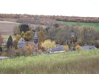 A general view of Lorleau | |
Location of Lorleau | |
 Lorleau  Lorleau | |
| Coordinates: 49°24′54″N 1°30′07″E / 49.415°N 1.502°E | |
| Country | France |
| Region | Normandy |
| Department | Eure |
| Arrondissement | Les Andelys |
| Canton | Romilly-sur-Andelle |
| Government | |
| • Mayor (2020–2026) | Chantal Grouchy[1] |
Area 1 | 12.31 km2 (4.75 sq mi) |
| Population (2022)[2] | 101 |
| • Density | 8.2/km2 (21/sq mi) |
| Time zone | UTC+01:00 (CET) |
| • Summer (DST) | UTC+02:00 (CEST) |
| INSEE/Postal code | 27373 /27480 |
| Elevation | 86–171 m (282–561 ft) (avg. 154 m or 505 ft) |
| 1 French Land Register data, which excludes lakes, ponds, glaciers > 1 km2 (0.386 sq mi or 247 acres) and river estuaries. | |
Lorleau (French pronunciation: [lɔʁlo]) is a commune in the Eure department in Normandy in northern France.
Population
| Year | Pop. | ±% p.a. |
|---|---|---|
| 1968 | 119 | — |
| 1975 | 111 | −0.99% |
| 1982 | 110 | −0.13% |
| 1990 | 118 | +0.88% |
| 1999 | 137 | +1.67% |
| 2009 | 147 | +0.71% |
| 2014 | 139 | −1.11% |
| 2020 | 105 | −4.57% |
| Source: INSEE[3] | ||
See also
References
- ^ "Répertoire national des élus: les maires". data.gouv.fr, Plateforme ouverte des données publiques françaises (in French). 9 August 2021.
- ^ "Populations de référence 2022" (in French). The National Institute of Statistics and Economic Studies. 19 December 2024.
- ^ Population en historique depuis 1968, INSEE
Wikimedia Commons has media related to Lorleau.