Beaucamps-le-Jeune
Beaucamps-le-Jeune | |
|---|---|
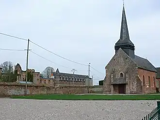 The church and chateau of Beaucamps-le-Jeune | |
Location of Beaucamps-le-Jeune | |
 Beaucamps-le-Jeune  Beaucamps-le-Jeune | |
| Coordinates: 49°49′01″N 1°46′22″E / 49.8169°N 1.7728°E | |
| Country | France |
| Region | Hauts-de-France |
| Department | Somme |
| Arrondissement | Amiens |
| Canton | Poix-de-Picardie |
| Intercommunality | CC Somme Sud-Ouest |
| Government | |
| • Mayor (2020–2026) | Stéphane Duchaussoy[1] |
Area 1 | 6.72 km2 (2.59 sq mi) |
| Population (2022)[2] | 193 |
| • Density | 29/km2 (74/sq mi) |
| Time zone | UTC+01:00 (CET) |
| • Summer (DST) | UTC+02:00 (CEST) |
| INSEE/Postal code | 80061 /80430 |
| Elevation | 155–211 m (509–692 ft) (avg. 220 m or 720 ft) |
| 1 French Land Register data, which excludes lakes, ponds, glaciers > 1 km2 (0.386 sq mi or 247 acres) and river estuaries. | |
Beaucamps-le-Jeune (French pronunciation: [bokɑ̃ lə ʒœn]; Picard: Bieucamp-Jonne) is a commune in the Somme department in Hauts-de-France in northern France.
Geography
The commune is situated on the D496 road, near the banks of the Bresle, the border of the departments of the Somme and Seine-Maritime.
Population
| Year | Pop. | ±% p.a. |
|---|---|---|
| 1968 | 214 | — |
| 1975 | 203 | −0.75% |
| 1982 | 177 | −1.94% |
| 1990 | 193 | +1.09% |
| 1999 | 187 | −0.35% |
| 2007 | 188 | +0.07% |
| 2012 | 208 | +2.04% |
| 2017 | 202 | −0.58% |
| Source: INSEE[3] | ||
See also
References
- ^ "Répertoire national des élus: les maires". data.gouv.fr, Plateforme ouverte des données publiques françaises (in French). 2 December 2020.
- ^ "Populations de référence 2022" (in French). The National Institute of Statistics and Economic Studies. 19 December 2024.
- ^ Population en historique depuis 1968, INSEE
Wikimedia Commons has media related to Beaucamps-le-Jeune.