Pont-de-Metz
Pont-de-Metz | |
|---|---|
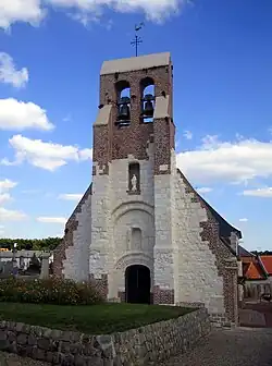 The church in Pont-de-Metz | |
Location of Pont-de-Metz | |
 Pont-de-Metz  Pont-de-Metz | |
| Coordinates: 49°52′50″N 2°14′34″E / 49.8806°N 2.2428°E | |
| Country | France |
| Region | Hauts-de-France |
| Department | Somme |
| Arrondissement | Amiens |
| Canton | Amiens-7 |
| Intercommunality | Amiens Métropole |
| Government | |
| • Mayor (2020–2026) | Loïc Bulant[1] |
Area 1 | 7.69 km2 (2.97 sq mi) |
| Population (2022)[2] | 2,440 |
| • Density | 320/km2 (820/sq mi) |
| Time zone | UTC+01:00 (CET) |
| • Summer (DST) | UTC+02:00 (CEST) |
| INSEE/Postal code | 80632 /80480 |
| Elevation | 22–85 m (72–279 ft) (avg. 28 m or 92 ft) |
| 1 French Land Register data, which excludes lakes, ponds, glaciers > 1 km2 (0.386 sq mi or 247 acres) and river estuaries. | |
Pont-de-Metz (French pronunciation: [pɔ̃ də mɛs]; Picard: Pont-Mès) is a commune in the Somme department in Hauts-de-France in northern France.
Geography
The commune is situated on the D405 road, less than 3 miles (5 km) southwest from the centre of Amiens.
Population
| Year | Pop. | ±% p.a. |
|---|---|---|
| 1968 | 1,064 | — |
| 1975 | 1,028 | −0.49% |
| 1982 | 1,231 | +2.61% |
| 1990 | 1,494 | +2.45% |
| 1999 | 1,656 | +1.15% |
| 2007 | 1,830 | +1.26% |
| 2012 | 2,387 | +5.46% |
| 2017 | 2,467 | +0.66% |
| Source: INSEE[3] | ||
Places of interest
- Church of Saint Cyr and Sainte-Julitte. Recently restored in the 21st century.
- The war memorial, at the entrance to the graveyard.
.jpg)
See also
References
- ^ "Répertoire national des élus: les maires". data.gouv.fr, Plateforme ouverte des données publiques françaises (in French). 2 December 2020.
- ^ "Populations de référence 2022" (in French). The National Institute of Statistics and Economic Studies. 19 December 2024.
- ^ Population en historique depuis 1968, INSEE
External links
Wikimedia Commons has media related to Pont-de-Metz.
- Municipal website (in French)