Cachy
Cachy | |
|---|---|
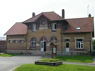 The town hall and school of Cachy | |
Location of Cachy | |
 Cachy  Cachy | |
| Coordinates: 49°51′10″N 2°28′51″E / 49.8528°N 2.4808°E / 49.8528; 2.4808 | |
| Country | France |
| Region | Hauts-de-France |
| Department | Somme |
| Arrondissement | Amiens |
| Canton | Amiens-4 |
| Intercommunality | Val de Somme |
| Government | |
| • Mayor (2020–2026) | François Debeugny[1] |
Area 1 | 6.11 km2 (2.36 sq mi) |
| Population (2022)[2] | 285 |
| • Density | 47/km2 (120/sq mi) |
| Time zone | UTC+01:00 (CET) |
| • Summer (DST) | UTC+02:00 (CEST) |
| INSEE/Postal code | 80159 /80800 |
| Elevation | 54–112 m (177–367 ft) (avg. 100 m or 330 ft) |
| 1 French Land Register data, which excludes lakes, ponds, glaciers > 1 km2 (0.386 sq mi or 247 acres) and river estuaries. | |
Cachy (French pronunciation: [kaʃi]; Picard: Cachin) is a commune in the Somme department in Hauts-de-France in northern France.
Geography
Cachy is situated on the D168 road, some 9 miles (14 km) southeast of Amiens and near to Villers-Bretonneux.
Population
| Year | Pop. | ±% p.a. |
|---|---|---|
| 1968 | 121 | — |
| 1975 | 110 | −1.35% |
| 1982 | 157 | +5.21% |
| 1990 | 166 | +0.70% |
| 1999 | 227 | +3.54% |
| 2007 | 248 | +1.11% |
| 2012 | 273 | +1.94% |
| 2017 | 282 | +0.65% |
| Source: INSEE[3] | ||
See also
References
- ^ "Répertoire national des élus: les maires". data.gouv.fr, Plateforme ouverte des données publiques françaises (in French). 2 December 2020.
- ^ "Populations de référence 2022" (in French). The National Institute of Statistics and Economic Studies. 19 December 2024.
- ^ Population en historique depuis 1968, INSEE
Wikimedia Commons has media related to Cachy.
This article is issued from Wikipedia. The text is available under Creative Commons Attribution-Share Alike 4.0 unless otherwise noted. Additional terms may apply for the media files.