Glisy
Glisy | |
|---|---|
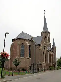 The church in Glisy | |
 Coat of arms | |
Location of Glisy | |
 Glisy  Glisy | |
| Coordinates: 49°52′42″N 2°23′57″E / 49.8783°N 2.3992°E | |
| Country | France |
| Region | Hauts-de-France |
| Department | Somme |
| Arrondissement | Amiens |
| Canton | Amiens-4 |
| Intercommunality | Amiens Métropole |
| Government | |
| • Mayor (2020–2026) | Guy Penaud[1] |
Area 1 | 5.55 km2 (2.14 sq mi) |
| Population (2022)[2] | 851 |
| • Density | 150/km2 (400/sq mi) |
| Time zone | UTC+01:00 (CET) |
| • Summer (DST) | UTC+02:00 (CEST) |
| INSEE/Postal code | 80379 /80440 |
| Elevation | 21–70 m (69–230 ft) (avg. 55 m or 180 ft) |
| 1 French Land Register data, which excludes lakes, ponds, glaciers > 1 km2 (0.386 sq mi or 247 acres) and river estuaries. | |
Glisy (French pronunciation: [ɡlizi]; Picard: Glisu) is a commune in the Somme department in Hauts-de-France in northern France.
Geography
Glisy is situated 5 miles (8 km) east of Amiens on the D4029 road. Amiens airport is within the boundaries of the village. It was used as a military base by the occupying German forces between 1940 and 1944.
Population
| Year | Pop. | ±% p.a. |
|---|---|---|
| 1968 | 370 | — |
| 1975 | 451 | +2.87% |
| 1982 | 532 | +2.39% |
| 1990 | 499 | −0.80% |
| 1999 | 483 | −0.36% |
| 2007 | 563 | +1.93% |
| 2012 | 619 | +1.91% |
| 2017 | 771 | +4.49% |
| Source: INSEE[3] | ||
See also
References
- ^ "Répertoire national des élus: les maires". data.gouv.fr, Plateforme ouverte des données publiques françaises (in French). 2 December 2020. Archived from the original on 28 June 2020. Retrieved 15 March 2021.
- ^ "Populations de référence 2022" (in French). The National Institute of Statistics and Economic Studies. 19 December 2024.
- ^ Population en historique depuis 1968, INSEE
Wikimedia Commons has media related to Glisy.