Neuilly-le-Dien
Neuilly-le-Dien | |
|---|---|
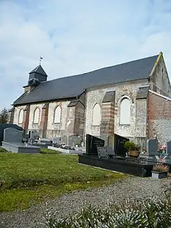 The church in Neuillly-le-Dien | |
 Coat of arms | |
Location of Neuilly-le-Dien | |
 Neuilly-le-Dien  Neuilly-le-Dien | |
| Coordinates: 50°13′28″N 2°02′37″E / 50.2244°N 2.0436°E | |
| Country | France |
| Region | Hauts-de-France |
| Department | Somme |
| Arrondissement | Abbeville |
| Canton | Rue |
| Intercommunality | CC Ponthieu-Marquenterre |
| Government | |
| • Mayor (2020–2026) | Philippe Sellier[1] |
Area 1 | 4.9 km2 (1.9 sq mi) |
| Population (2022)[2] | 103 |
| • Density | 21/km2 (54/sq mi) |
| Time zone | UTC+01:00 (CET) |
| • Summer (DST) | UTC+02:00 (CEST) |
| INSEE/Postal code | 80589 /80150 |
| Elevation | 40–101 m (131–331 ft) (avg. 100 m or 330 ft) |
| 1 French Land Register data, which excludes lakes, ponds, glaciers > 1 km2 (0.386 sq mi or 247 acres) and river estuaries. | |
Neuilly-le-Dien (French pronunciation: [nœji lə djɛ̃]) is a commune in the Somme department in Hauts-de-France in northern France.
Geography
The commune is situated on the D938 road, some 15 miles (24 km) northeast of Abbeville.
Population
| Year | Pop. | ±% p.a. |
|---|---|---|
| 1968 | 154 | — |
| 1975 | 114 | −4.21% |
| 1982 | 97 | −2.28% |
| 1990 | 103 | +0.75% |
| 1999 | 110 | +0.73% |
| 2007 | 105 | −0.58% |
| 2012 | 94 | −2.19% |
| 2017 | 96 | +0.42% |
| Source: INSEE[3] | ||
See also
References
- ^ "Répertoire national des élus: les maires". data.gouv.fr, Plateforme ouverte des données publiques françaises (in French). 2 December 2020.
- ^ "Populations de référence 2022" (in French). The National Institute of Statistics and Economic Studies. 19 December 2024.
- ^ Population en historique depuis 1968, INSEE
Wikimedia Commons has media related to Neuilly-le-Dien.