Cléville, Calvados
Cléville | |
|---|---|
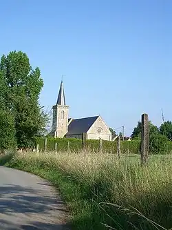 The church in Cléville | |
.svg.png) Coat of arms | |
Location of Cléville | |
 Cléville  Cléville | |
| Coordinates: 49°09′24″N 0°05′29″W / 49.1567°N 0.0914°W | |
| Country | France |
| Region | Normandy |
| Department | Calvados |
| Arrondissement | Caen |
| Canton | Troarn |
| Intercommunality | CC Val ès Dunes |
| Government | |
| • Mayor (2020–2026) | Michel Cruchon[1] |
Area 1 | 8.53 km2 (3.29 sq mi) |
| Population (2022)[2] | 391 |
| • Density | 46/km2 (120/sq mi) |
| Time zone | UTC+01:00 (CET) |
| • Summer (DST) | UTC+02:00 (CEST) |
| INSEE/Postal code | 14163 /14370 |
| Elevation | 2–43 m (6.6–141.1 ft) (avg. 26 m or 85 ft) |
| 1 French Land Register data, which excludes lakes, ponds, glaciers > 1 km2 (0.386 sq mi or 247 acres) and river estuaries. | |
Cléville (French pronunciation: [klevil] ⓘ) is a commune in the Calvados department in the Normandy region in northwestern France.
Population
| Year | Pop. | ±% |
|---|---|---|
| 1962 | 257 | — |
| 1968 | 223 | −13.2% |
| 1975 | 215 | −3.6% |
| 1982 | 242 | +12.6% |
| 1990 | 298 | +23.1% |
| 1999 | 269 | −9.7% |
| 2008 | 340 | +26.4% |
See also
References
- ^ "Répertoire national des élus: les maires" (in French). data.gouv.fr, Plateforme ouverte des données publiques françaises. 13 September 2022.
- ^ "Populations de référence 2022" (in French). The National Institute of Statistics and Economic Studies. 19 December 2024.
Wikimedia Commons has media related to Cléville, Calvados.