Dobrochov
Dobrochov | |
|---|---|
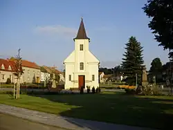 Centre of Dobrochov | |
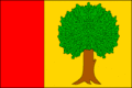 Flag 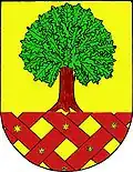 Coat of arms | |
 Dobrochov Location in the Czech Republic | |
| Coordinates: 49°23′9″N 17°6′20″E / 49.38583°N 17.10556°E | |
| Country | |
| Region | Olomouc |
| District | Prostějov |
| First mentioned | 1141 |
| Area | |
• Total | 2.53 km2 (0.98 sq mi) |
| Elevation | 237 m (778 ft) |
| Population (2025-01-01)[1] | |
• Total | 363 |
| • Density | 140/km2 (370/sq mi) |
| Time zone | UTC+1 (CET) |
| • Summer (DST) | UTC+2 (CEST) |
| Postal code | 798 07 |
| Website | www |
Dobrochov is a municipality and village in Prostějov District in the Olomouc Region of the Czech Republic. It has about 400 inhabitants.
Geography
Dobrochov is located about 9 km (6 mi) south of Prostějov and 24 km (15 mi) southwest of Olomouc. It lies in an agricultural landscape in the Upper Morava Valley. The highest point is at 298 m (978 ft) above sea level.
Demographics
| Year | Pop. | ±% |
|---|---|---|
| 1869 | 320 | — |
| 1880 | 314 | −1.9% |
| 1890 | 296 | −5.7% |
| 1900 | 333 | +12.5% |
| 1910 | 341 | +2.4% |
| 1921 | 354 | +3.8% |
| 1930 | 338 | −4.5% |
| 1950 | 358 | +5.9% |
| 1961 | 328 | −8.4% |
| 1970 | 302 | −7.9% |
| 1980 | 254 | −15.9% |
| 1991 | 249 | −2.0% |
| 2001 | 259 | +4.0% |
| 2011 | 292 | +12.7% |
| 2021 | 330 | +13.0% |
| Source: Censuses[2][3] | ||
Transport
The D46 motorway from Olomouc to Vyškov passes through the municipality.
References
- ^ "Population of Municipalities – 1 January 2025". Czech Statistical Office. 2025-05-16.
- ^ "Historický lexikon obcí České republiky 1869–2011" (in Czech). Czech Statistical Office. 2015-12-21.
- ^ "Population Census 2021: Population by sex". Public Database. Czech Statistical Office. 2021-03-27.
External links
Wikimedia Commons has media related to Dobrochov.