Rozstání (Prostějov District)
Rozstání | |
|---|---|
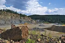 Quarry in Baldovec | |
_vlajka.jpg) Flag _znak.jpg) Coat of arms | |
 Rozstání Location in the Czech Republic | |
| Coordinates: 49°23′52″N 16°50′25″E / 49.39778°N 16.84028°E | |
| Country | |
| Region | Olomouc |
| District | Prostějov |
| First mentioned | 1358 |
| Area | |
• Total | 16.52 km2 (6.38 sq mi) |
| Elevation | 545 m (1,788 ft) |
| Population (2025-01-01)[1] | |
• Total | 624 |
| • Density | 38/km2 (98/sq mi) |
| Time zone | UTC+1 (CET) |
| • Summer (DST) | UTC+2 (CEST) |
| Postal codes | 798 61, 798 62 |
| Website | www |
Rozstání is a municipality and village in Prostějov District in the Olomouc Region of the Czech Republic. It has about 600 inhabitants.
Rozstání lies approximately 21 kilometres (13 mi) south-west of Prostějov, 37 km (23 mi) south-west of Olomouc, and 191 km (119 mi) south-east of Prague.
Administrative division
Rozstání consists of two municipal parts (in brackets population according to the 2021 census):[2]
- Rozstání (534)
- Baldovec (104)
Demographics
| Year | Pop. | ±% |
|---|---|---|
| 1869 | 1,144 | — |
| 1880 | 1,212 | +5.9% |
| 1890 | 1,268 | +4.6% |
| 1900 | 1,327 | +4.7% |
| 1910 | 1,350 | +1.7% |
| 1921 | 1,334 | −1.2% |
| 1930 | 1,283 | −3.8% |
| 1950 | 1,089 | −15.1% |
| 1961 | 1,175 | +7.9% |
| 1970 | 1,047 | −10.9% |
| 1980 | 880 | −16.0% |
| 1991 | 752 | −14.5% |
| 2001 | 685 | −8.9% |
| 2011 | 643 | −6.1% |
| 2021 | 638 | −0.8% |
| Source: Censuses[3][4] | ||
References
- ^ "Population of Municipalities – 1 January 2025". Czech Statistical Office. 2025-05-16.
- ^ "Public Census 2021 – basic data". Public Database (in Czech). Czech Statistical Office. 2022.
- ^ "Historický lexikon obcí České republiky 1869–2011" (in Czech). Czech Statistical Office. 2015-12-21.
- ^ "Population Census 2021: Population by sex". Public Database. Czech Statistical Office. 2021-03-27.
External links
Wikimedia Commons has media related to Rozstání (Prostějov District).