Hradčany-Kobeřice
Hradčany-Kobeřice | |
|---|---|
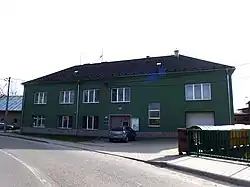 Municipal office | |
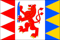 Flag 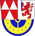 Coat of arms | |
 Hradčany-Kobeřice Location in the Czech Republic | |
| Coordinates: 49°21′51″N 17°7′45″E / 49.36417°N 17.12917°E | |
| Country | |
| Region | Olomouc |
| District | Prostějov |
| First mentioned | 1160 |
| Area | |
• Total | 6.91 km2 (2.67 sq mi) |
| Elevation | 221 m (725 ft) |
| Population (2025-01-01)[1] | |
• Total | 398 |
| • Density | 58/km2 (150/sq mi) |
| Time zone | UTC+1 (CET) |
| • Summer (DST) | UTC+2 (CEST) |
| Postal code | 798 07 |
| Website | www |
Hradčany-Kobeřice is a municipality in Prostějov District in the Olomouc Region of the Czech Republic. It has about 400 inhabitants.
Hradčany-Kobeřice lies approximately 12 kilometres (7 mi) south of Prostějov, 27 km (17 mi) south of Olomouc, and 210 km (130 mi) east of Prague.
Administrative division
Hradčany-Kobeřice consists of two municipal parts (in brackets population according to the 2021 census):[2]
- Hradčany (221)
- Kobeřice (171)
Demographics
| Year | Pop. | ±% |
|---|---|---|
| 1869 | 715 | — |
| 1880 | 745 | +4.2% |
| 1890 | 766 | +2.8% |
| 1900 | 730 | −4.7% |
| 1910 | 810 | +11.0% |
| 1921 | 739 | −8.8% |
| 1930 | 810 | +9.6% |
| 1950 | 628 | −22.5% |
| 1961 | 625 | −0.5% |
| 1970 | 554 | −11.4% |
| 1980 | 432 | −22.0% |
| 1991 | 358 | −17.1% |
| 2001 | 410 | +14.5% |
| 2011 | 435 | +6.1% |
| 2021 | 392 | −9.9% |
| Source: Censuses[3][4] | ||
References
- ^ "Population of Municipalities – 1 January 2025". Czech Statistical Office. 2025-05-16.
- ^ "Public Census 2021 – basic data". Public Database (in Czech). Czech Statistical Office. 2022.
- ^ "Historický lexikon obcí České republiky 1869–2011" (in Czech). Czech Statistical Office. 2015-12-21.
- ^ "Population Census 2021: Population by sex". Public Database. Czech Statistical Office. 2021-03-27.
External links
Wikimedia Commons has media related to Hradčany-Kobeřice.