Seloutky
Seloutky | |
|---|---|
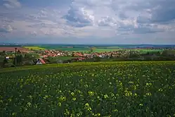 View from the west | |
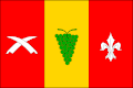 Flag 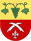 Coat of arms | |
 Seloutky Location in the Czech Republic | |
| Coordinates: 49°26′29″N 17°3′48″E / 49.44139°N 17.06333°E | |
| Country | |
| Region | Olomouc |
| District | Prostějov |
| First mentioned | 1325 |
| Area | |
• Total | 7.16 km2 (2.76 sq mi) |
| Elevation | 256 m (840 ft) |
| Population (2025-01-01)[1] | |
• Total | 536 |
| • Density | 75/km2 (190/sq mi) |
| Time zone | UTC+1 (CET) |
| • Summer (DST) | UTC+2 (CEST) |
| Postal code | 798 04 |
| Website | seloutky |
Seloutky is a municipality and village in Prostějov District in the Olomouc Region of the Czech Republic. It has about 500 inhabitants.
Seloutky lies approximately 6 kilometres (4 mi) south-west of Prostějov, 22 km (14 mi) south-west of Olomouc, and 203 km (126 mi) east of Prague.
Demographics
| Year | Pop. | ±% |
|---|---|---|
| 1869 | 437 | — |
| 1880 | 462 | +5.7% |
| 1890 | 496 | +7.4% |
| 1900 | 505 | +1.8% |
| 1910 | 563 | +11.5% |
| 1921 | 558 | −0.9% |
| 1930 | 529 | −5.2% |
| 1950 | 521 | −1.5% |
| 1961 | 543 | +4.2% |
| 1970 | 518 | −4.6% |
| 1980 | 462 | −10.8% |
| 1991 | 411 | −11.0% |
| 2001 | 430 | +4.6% |
| 2011 | 495 | +15.1% |
| 2021 | 508 | +2.6% |
| Source: Censuses[2][3] | ||
References
- ^ "Population of Municipalities – 1 January 2025". Czech Statistical Office. 2025-05-16.
- ^ "Historický lexikon obcí České republiky 1869–2011" (in Czech). Czech Statistical Office. 2015-12-21.
- ^ "Population Census 2021: Population by sex". Public Database. Czech Statistical Office. 2021-03-27.
External links
Wikimedia Commons has media related to Seloutky.