Skřípov
Skřípov | |
|---|---|
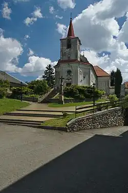 Church of the Ascension of the Lord | |
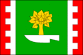 Flag  Coat of arms | |
 Skřípov Location in the Czech Republic | |
| Coordinates: 49°35′0″N 16°49′13″E / 49.58333°N 16.82028°E | |
| Country | |
| Region | Olomouc |
| District | Prostějov |
| First mentioned | 1553 |
| Area | |
• Total | 11.08 km2 (4.28 sq mi) |
| Elevation | 578 m (1,896 ft) |
| Population (2025-01-01)[1] | |
• Total | 332 |
| • Density | 30/km2 (78/sq mi) |
| Time zone | UTC+1 (CET) |
| • Summer (DST) | UTC+2 (CEST) |
| Postal code | 798 52 |
| Website | www |
Skřípov (German: Wachtl) is a municipality and village in Prostějov District in the Olomouc Region of the Czech Republic. It has about 300 inhabitants.
Skřípov lies approximately 25 kilometres (16 mi) north-west of Prostějov, 32 km (20 mi) west of Olomouc, and 182 km (113 mi) east of Prague.
Demographics
| Year | Pop. | ±% |
|---|---|---|
| 1869 | 1,934 | — |
| 1880 | 2,066 | +6.8% |
| 1890 | 2,086 | +1.0% |
| 1900 | 1,921 | −7.9% |
| 1910 | 1,797 | −6.5% |
| 1921 | 1,653 | −8.0% |
| 1930 | 1,566 | −5.3% |
| 1950 | 612 | −60.9% |
| 1961 | 642 | +4.9% |
| 1970 | 513 | −20.1% |
| 1980 | 440 | −14.2% |
| 1991 | 350 | −20.5% |
| 2001 | 346 | −1.1% |
| 2011 | 347 | +0.3% |
| 2021 | 305 | −12.1% |
| Source: Censuses[2][3] | ||
References
- ^ "Population of Municipalities – 1 January 2025". Czech Statistical Office. 2025-05-16.
- ^ "Historický lexikon obcí České republiky 1869–2011" (in Czech). Czech Statistical Office. 2015-12-21.
- ^ "Population Census 2021: Population by sex". Public Database. Czech Statistical Office. 2021-03-27.
External links
Wikimedia Commons has media related to Skřípov.