Espartignac
Espartignac | |
|---|---|
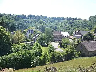 A general view of Espartignac | |
.svg.png) Coat of arms | |
Location of Espartignac | |
 Espartignac  Espartignac | |
| Coordinates: 45°24′56″N 1°35′47″E / 45.4156°N 1.5964°E | |
| Country | France |
| Region | Nouvelle-Aquitaine |
| Department | Corrèze |
| Arrondissement | Tulle |
| Canton | Uzerche |
| Intercommunality | Pays d'Uzerche |
| Government | |
| • Mayor (2020–2026) | Jean-Michel Faugeras[1] |
Area 1 | 14.03 km2 (5.42 sq mi) |
| Population (2022)[2] | 409 |
| • Density | 29/km2 (76/sq mi) |
| Time zone | UTC+01:00 (CET) |
| • Summer (DST) | UTC+02:00 (CEST) |
| INSEE/Postal code | 19076 /19140 |
| Elevation | 292–472 m (958–1,549 ft) (avg. 350 m or 1,150 ft) |
| 1 French Land Register data, which excludes lakes, ponds, glaciers > 1 km2 (0.386 sq mi or 247 acres) and river estuaries. | |
Espartignac (French pronunciation: [ɛspaʁtiɲak]; Occitan: Espartinhac) is a commune in the Corrèze department in central France.
Population
| Year | Pop. | ±% |
|---|---|---|
| 1962 | 299 | — |
| 1968 | 326 | +9.0% |
| 1975 | 321 | −1.5% |
| 1982 | 344 | +7.2% |
| 1990 | 342 | −0.6% |
| 1999 | 385 | +12.6% |
| 2008 | 381 | −1.0% |
See also
References
- ^ "Répertoire national des élus: les maires". data.gouv.fr, Plateforme ouverte des données publiques françaises (in French). 9 August 2021.
- ^ "Populations de référence 2022" (in French). The National Institute of Statistics and Economic Studies. 19 December 2024.
Wikimedia Commons has media related to Espartignac.