Pohledy
Pohledy | |
|---|---|
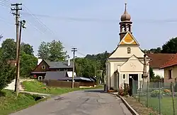 Centre of Pohledy with the Chapel of Saint Vitus | |
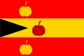 Flag 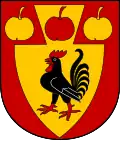 Coat of arms | |
 Pohledy Location in the Czech Republic | |
| Coordinates: 49°41′42″N 16°33′38″E / 49.69500°N 16.56056°E | |
| Country | |
| Region | Pardubice |
| District | Svitavy |
| First mentioned | 1365 |
| Area | |
• Total | 19.91 km2 (7.69 sq mi) |
| Elevation | 495 m (1,624 ft) |
| Population (2025-01-01)[1] | |
• Total | 305 |
| • Density | 15/km2 (40/sq mi) |
| Time zone | UTC+1 (CET) |
| • Summer (DST) | UTC+2 (CEST) |
| Postal code | 568 02 |
| Website | www |
Pohledy is a municipality and village in Svitavy District in the Pardubice Region of the Czech Republic. It has about 300 inhabitants.
Pohledy lies approximately 10 kilometres (6 mi) south-east of Svitavy, 69 km (43 mi) south-east of Pardubice, and 160 km (99 mi) east of Prague.
Administrative division
Pohledy consists of two municipal parts (in brackets population according to the 2021 census):[2]
- Pohledy (89)
- Horní Hynčina (204)
Demographics
| Year | Pop. | ±% |
|---|---|---|
| 1869 | 1,551 | — |
| 1880 | 1,688 | +8.8% |
| 1890 | 1,670 | −1.1% |
| 1900 | 1,711 | +2.5% |
| 1910 | 1,652 | −3.4% |
| 1921 | 1,449 | −12.3% |
| 1930 | 1,455 | +0.4% |
| 1950 | 656 | −54.9% |
| 1961 | 588 | −10.4% |
| 1970 | 538 | −8.5% |
| 1980 | 426 | −20.8% |
| 1991 | 350 | −17.8% |
| 2001 | 334 | −4.6% |
| 2011 | 297 | −11.1% |
| 2021 | 293 | −1.3% |
| Source: Censuses[3][4] | ||
References
- ^ "Population of Municipalities – 1 January 2025". Czech Statistical Office. 2025-05-16.
- ^ "Public Census 2021 – basic data". Public Database (in Czech). Czech Statistical Office. 2022.
- ^ "Historický lexikon obcí České republiky 1869–2011" (in Czech). Czech Statistical Office. 2015-12-21.
- ^ "Population Census 2021: Population by sex". Public Database. Czech Statistical Office. 2021-03-27.
External links
Wikimedia Commons has media related to Pohledy.