Rohozná (Svitavy District)
Rohozná | |
|---|---|
%252C_kostel_(2).jpg) Church of Saint Erasmus | |
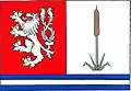 Flag 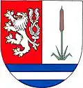 Coat of arms | |
 Rohozná Location in the Czech Republic | |
| Coordinates: 49°39′13″N 16°24′29″E / 49.65361°N 16.40806°E | |
| Country | |
| Region | Pardubice |
| District | Svitavy |
| First mentioned | 1349 |
| Area | |
• Total | 11.78 km2 (4.55 sq mi) |
| Elevation | 575 m (1,886 ft) |
| Population (2025-01-01)[1] | |
• Total | 625 |
| • Density | 53/km2 (140/sq mi) |
| Time zone | UTC+1 (CET) |
| • Summer (DST) | UTC+2 (CEST) |
| Postal codes | 569 72, 569 92 |
| Website | www |
Rohozná is a municipality and village in Svitavy District in the Pardubice Region of the Czech Republic. It has about 600 inhabitants.
Rohozná lies approximately 12 kilometres (7 mi) south-west of Svitavy, 62 km (39 mi) south-east of Pardubice, and 150 km (93 mi) east of Prague.
Administrative division
Rohozná consists of two municipal parts (in brackets population according to the 2021 census):[2]
- Rohozná (589)
- Manova Lhota (17)
Demographics
| Year | Pop. | ±% |
|---|---|---|
| 1869 | 1,785 | — |
| 1880 | 1,828 | +2.4% |
| 1890 | 1,872 | +2.4% |
| 1900 | 2,055 | +9.8% |
| 1910 | 2,197 | +6.9% |
| 1921 | 2,054 | −6.5% |
| 1930 | 2,026 | −1.4% |
| 1950 | 1,161 | −42.7% |
| 1961 | 1,251 | +7.8% |
| 1970 | 1,141 | −8.8% |
| 1980 | 956 | −16.2% |
| 1991 | 763 | −20.2% |
| 2001 | 715 | −6.3% |
| 2011 | 657 | −8.1% |
| 2021 | 606 | −7.8% |
| Source: Censuses[3][4] | ||
References
- ^ "Population of Municipalities – 1 January 2025". Czech Statistical Office. 2025-05-16.
- ^ "Public Census 2021 – basic data". Public Database (in Czech). Czech Statistical Office. 2022.
- ^ "Historický lexikon obcí České republiky 1869–2011" (in Czech). Czech Statistical Office. 2015-12-21.
- ^ "Population Census 2021: Population by sex". Public Database. Czech Statistical Office. 2021-03-27.
External links
Wikimedia Commons has media related to Rohozná (Svitavy District).