Suchá Lhota
Suchá Lhota | |
|---|---|
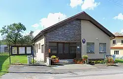 Municipal office | |
 Flag  Coat of arms | |
 Suchá Lhota Location in the Czech Republic | |
| Coordinates: 49°52′38″N 16°10′25″E / 49.87722°N 16.17361°E | |
| Country | |
| Region | Pardubice |
| District | Svitavy |
| First mentioned | 1559 |
| Area | |
• Total | 2.19 km2 (0.85 sq mi) |
| Elevation | 426 m (1,398 ft) |
| Population (2025-01-01)[1] | |
• Total | 80 |
| • Density | 37/km2 (95/sq mi) |
| Time zone | UTC+1 (CET) |
| • Summer (DST) | UTC+2 (CEST) |
| Postal code | 570 01 |
| Website | www |
Suchá Lhota is a municipality and village in Svitavy District in the Pardubice Region of the Czech Republic. It has about 80 inhabitants.
Suchá Lhota lies approximately 26 kilometres (16 mi) north-west of Svitavy, 34 km (21 mi) south-east of Pardubice, and 128 km (80 mi) east of Prague.
Demographics
| Year | Pop. | ±% |
|---|---|---|
| 1869 | 198 | — |
| 1880 | 230 | +16.2% |
| 1890 | 240 | +4.3% |
| 1900 | 234 | −2.5% |
| 1910 | 225 | −3.8% |
| 1921 | 228 | +1.3% |
| 1930 | 208 | −8.8% |
| 1950 | 140 | −32.7% |
| 1961 | 131 | −6.4% |
| 1970 | 111 | −15.3% |
| 1980 | 104 | −6.3% |
| 1991 | 98 | −5.8% |
| 2001 | 90 | −8.2% |
| 2011 | 84 | −6.7% |
| 2021 | 91 | +8.3% |
| Source: Censuses[2][3] | ||
References
- ^ "Population of Municipalities – 1 January 2025". Czech Statistical Office. 2025-05-16.
- ^ "Historický lexikon obcí České republiky 1869–2011" (in Czech). Czech Statistical Office. 2015-12-21.
- ^ "Population Census 2021: Population by sex". Public Database. Czech Statistical Office. 2021-03-27.
External links
Wikimedia Commons has media related to Suchá Lhota.