Saint-Polycarpe
Saint-Polycarpe | |
|---|---|
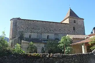 Abbey church | |
.svg.png) Coat of arms | |
Location of Saint-Polycarpe | |
 Saint-Polycarpe  Saint-Polycarpe | |
| Coordinates: 43°02′00″N 2°18′00″E / 43.0333°N 2.3°E | |
| Country | France |
| Region | Occitania |
| Department | Aude |
| Arrondissement | Limoux |
| Canton | La Région Limouxine |
| Government | |
| • Mayor (2020–2026) | Jean Laffont[1] |
Area 1 | 13.81 km2 (5.33 sq mi) |
| Population (2022)[2] | 160 |
| • Density | 12/km2 (30/sq mi) |
| Time zone | UTC+01:00 (CET) |
| • Summer (DST) | UTC+02:00 (CEST) |
| INSEE/Postal code | 11364 /11300 |
| Elevation | 194–806 m (636–2,644 ft) |
| 1 French Land Register data, which excludes lakes, ponds, glaciers > 1 km2 (0.386 sq mi or 247 acres) and river estuaries. | |
Saint-Polycarpe (Languedocien: Sant Policarpi) is a commune in the Aude department in southern France.
Population
| Year | Pop. | ±% p.a. |
|---|---|---|
| 1968 | 158 | — |
| 1975 | 175 | +1.47% |
| 1982 | 188 | +1.03% |
| 1990 | 200 | +0.78% |
| 1999 | 185 | −0.86% |
| 2009 | 165 | −1.14% |
| 2014 | 138 | −3.51% |
| 2020 | 141 | +0.36% |
| Source: INSEE[3] | ||
See also
References
- ^ "Répertoire national des élus: les maires". data.gouv.fr, Plateforme ouverte des données publiques françaises (in French). 9 August 2021.
- ^ "Populations de référence 2022" (in French). The National Institute of Statistics and Economic Studies. 19 December 2024.
- ^ Population en historique depuis 1968, INSEE
Wikimedia Commons has media related to Saint-Polycarpe.