Trnovany
Trnovany | |
|---|---|
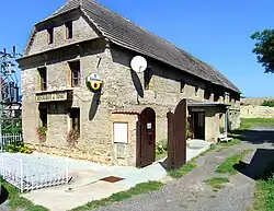 Restaurant in the centre of Trnovany | |
 Flag 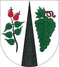 Coat of arms | |
 Trnovany Location in the Czech Republic | |
| Coordinates: 50°32′36″N 14°40′45″E / 50.54333°N 14.67917°E | |
| Country | |
| Region | Ústí nad Labem |
| District | Litoměřice |
| First mentioned | 1057 |
| Area | |
• Total | 3.04 km2 (1.17 sq mi) |
| Elevation | 212 m (696 ft) |
| Population (2025-01-01)[1] | |
• Total | 482 |
| • Density | 160/km2 (410/sq mi) |
| Time zone | UTC+1 (CET) |
| • Summer (DST) | UTC+2 (CEST) |
| Postal code | 412 01 |
| Website | www |
Trnovany is a municipality and village in Litoměřice District in the Ústí nad Labem Region of the Czech Republic. It has about 500 inhabitants.
Trnovany lies approximately 5 kilometres (3 mi) east of Litoměřice, 17 km (11 mi) south-east of Ústí nad Labem, and 54 km (34 mi) north of Prague.
Administrative division
Trnovany consists of two municipal parts (in brackets population according to the 2021 census):[2]
- Trnovany (116)
- Podviní (300)
Demographics
| Year | Pop. | ±% |
|---|---|---|
| 1869 | 364 | — |
| 1880 | 354 | −2.7% |
| 1890 | 355 | +0.3% |
| 1900 | 438 | +23.4% |
| 1910 | 446 | +1.8% |
| 1921 | 414 | −7.2% |
| 1930 | 475 | +14.7% |
| 1950 | 266 | −44.0% |
| 1961 | 258 | −3.0% |
| 1970 | 248 | −3.9% |
| 1980 | 274 | +10.5% |
| 1991 | 270 | −1.5% |
| 2001 | 289 | +7.0% |
| 2011 | 340 | +17.6% |
| 2021 | 416 | +22.4% |
| Source: Censuses[3][4] | ||
References
- ^ "Population of Municipalities – 1 January 2025". Czech Statistical Office. 2025-05-16.
- ^ "Public Census 2021 – basic data". Public Database (in Czech). Czech Statistical Office. 2022.
- ^ "Historický lexikon obcí České republiky 1869–2011" (in Czech). Czech Statistical Office. 2015-12-21.
- ^ "Population Census 2021: Population by sex". Public Database. Czech Statistical Office. 2021-03-27.
External links
Wikimedia Commons has media related to Trnovany.