Bratřice
Bratřice | |
|---|---|
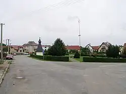 Centre of Bratřice | |
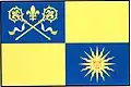 Flag 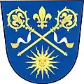 Coat of arms | |
 Bratřice Location in the Czech Republic | |
| Coordinates: 49°30′59″N 15°0′5″E / 49.51639°N 15.00139°E | |
| Country | |
| Region | Vysočina |
| District | Pelhřimov |
| First mentioned | 1273 |
| Area | |
• Total | 10.35 km2 (4.00 sq mi) |
| Elevation | 568 m (1,864 ft) |
| Population (2025-01-01)[1] | |
• Total | 163 |
| • Density | 16/km2 (41/sq mi) |
| Time zone | UTC+1 (CET) |
| • Summer (DST) | UTC+2 (CEST) |
| Postal code | 395 01 |
| Website | www |
Bratřice is a municipality and village in Pelhřimov District in the Vysočina Region of the Czech Republic. It has about 200 inhabitants.
Bratřice lies approximately 19 kilometres (12 mi) north-west of Pelhřimov, 45 km (28 mi) west of Jihlava, and 76 km (47 mi) south-east of Prague.
Administrative division
Bratřice consists of two municipal parts (in brackets population according to the 2021 census):[2]
- Bratřice (130)
- Cetule (8)
Demographics
| Year | Pop. | ±% |
|---|---|---|
| 1869 | 639 | — |
| 1880 | 542 | −15.2% |
| 1890 | 456 | −15.9% |
| 1900 | 428 | −6.1% |
| 1910 | 416 | −2.8% |
| 1921 | 362 | −13.0% |
| 1930 | 368 | +1.7% |
| 1950 | 254 | −31.0% |
| 1961 | 267 | +5.1% |
| 1970 | 243 | −9.0% |
| 1980 | 220 | −9.5% |
| 1991 | 196 | −10.9% |
| 2001 | 182 | −7.1% |
| 2011 | 148 | −18.7% |
| 2021 | 138 | −6.8% |
| Source: Censuses[3][4] | ||
References
- ^ "Population of Municipalities – 1 January 2025". Czech Statistical Office. 2025-05-16.
- ^ "Public Census 2021 – basic data". Public Database (in Czech). Czech Statistical Office. 2022.
- ^ "Historický lexikon obcí České republiky 1869–2011" (in Czech). Czech Statistical Office. 2015-12-21.
- ^ "Population Census 2021: Population by sex". Public Database. Czech Statistical Office. 2021-03-27.
External links
Wikimedia Commons has media related to Bratřice.