Včelnička
Včelnička | |
|---|---|
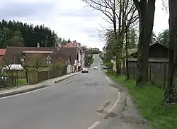 Main street | |
 Coat of arms | |
 Včelnička Location in the Czech Republic | |
| Coordinates: 49°18′16″N 15°2′33″E / 49.30444°N 15.04250°E | |
| Country | |
| Region | Vysočina |
| District | Pelhřimov |
| First mentioned | 1379 |
| Area | |
• Total | 3.95 km2 (1.53 sq mi) |
| Elevation | 555 m (1,821 ft) |
| Population (2025-01-01)[1] | |
• Total | 265 |
| • Density | 67/km2 (170/sq mi) |
| Time zone | UTC+1 (CET) |
| • Summer (DST) | UTC+2 (CEST) |
| Postal code | 394 70 |
| Website | vcelnicka |
Včelnička (German: Bienental) is a municipality and village in Pelhřimov District in the Vysočina Region of the Czech Republic. It has about 300 inhabitants.
Včelnička lies approximately 19 kilometres (12 mi) south-west of Pelhřimov, 41 km (25 mi) west of Jihlava, and 98 km (61 mi) south-east of Prague.
Demographics
| Year | Pop. | ±% |
|---|---|---|
| 1869 | 380 | — |
| 1880 | 480 | +26.3% |
| 1890 | 524 | +9.2% |
| 1900 | 573 | +9.4% |
| 1910 | 401 | −30.0% |
| 1921 | 371 | −7.5% |
| 1930 | 349 | −5.9% |
| 1950 | 298 | −14.6% |
| 1961 | 334 | +12.1% |
| 1970 | 296 | −11.4% |
| 1980 | 215 | −27.4% |
| 1991 | 186 | −13.5% |
| 2001 | 196 | +5.4% |
| 2011 | 179 | −8.7% |
| 2021 | 236 | +31.8% |
| Source: Censuses[2][3] | ||
References
- ^ "Population of Municipalities – 1 January 2025". Czech Statistical Office. 2025-05-16.
- ^ "Historický lexikon obcí České republiky 1869–2011" (in Czech). Czech Statistical Office. 2015-12-21.
- ^ "Population Census 2021: Population by sex". Public Database. Czech Statistical Office. 2021-03-27.
External links
Wikimedia Commons has media related to Včelnička.