Kejžlice
Kejžlice | |
|---|---|
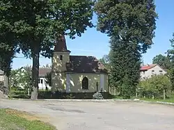 Chapel in Kejžlice | |
 Flag  Coat of arms | |
 Kejžlice Location in the Czech Republic | |
| Coordinates: 49°35′26″N 15°23′34″E / 49.59056°N 15.39278°E | |
| Country | |
| Region | Vysočina |
| District | Pelhřimov |
| First mentioned | 1378 |
| Area | |
• Total | 11.27 km2 (4.35 sq mi) |
| Elevation | 470 m (1,540 ft) |
| Population (2025-01-01)[1] | |
• Total | 471 |
| • Density | 42/km2 (110/sq mi) |
| Time zone | UTC+1 (CET) |
| • Summer (DST) | UTC+2 (CEST) |
| Postal code | 394 52 |
| Website | www |
Kejžlice is a municipality and village in Pelhřimov District in the Vysočina Region of the Czech Republic. It has about 500 inhabitants.
Kejžlice lies approximately 22 kilometres (14 mi) north-east of Pelhřimov, 26 km (16 mi) north-west of Jihlava, and 90 km (56 mi) south-east of Prague.
Demographics
| Year | Pop. | ±% |
|---|---|---|
| 1869 | 720 | — |
| 1880 | 735 | +2.1% |
| 1890 | 710 | −3.4% |
| 1900 | 641 | −9.7% |
| 1910 | 670 | +4.5% |
| 1921 | 702 | +4.8% |
| 1930 | 685 | −2.4% |
| 1950 | 596 | −13.0% |
| 1961 | 577 | −3.2% |
| 1970 | 464 | −19.6% |
| 1980 | 372 | −19.8% |
| 1991 | 345 | −7.3% |
| 2001 | 328 | −4.9% |
| 2011 | 339 | +3.4% |
| 2021 | 433 | +27.7% |
| Source: Censuses[2][3] | ||
References
- ^ "Population of Municipalities – 1 January 2025". Czech Statistical Office. 2025-05-16.
- ^ "Historický lexikon obcí České republiky 1869–2011" (in Czech). Czech Statistical Office. 2015-12-21.
- ^ "Population Census 2021: Population by sex". Public Database. Czech Statistical Office. 2021-03-27.
External links
Wikimedia Commons has media related to Kejžlice.