Zajíčkov
Zajíčkov | |
|---|---|
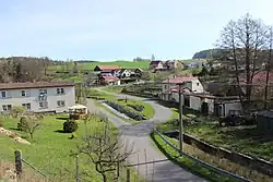 Centre of Zajíčkov | |
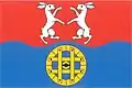 Flag 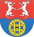 Coat of arms | |
 Zajíčkov Location in the Czech Republic | |
| Coordinates: 49°22′41″N 15°15′29″E / 49.37806°N 15.25806°E | |
| Country | |
| Region | Vysočina |
| District | Pelhřimov |
| First mentioned | 1203 |
| Area | |
• Total | 4.54 km2 (1.75 sq mi) |
| Elevation | 580 m (1,900 ft) |
| Population (2025-01-01)[1] | |
• Total | 227 |
| • Density | 50/km2 (130/sq mi) |
| Time zone | UTC+1 (CET) |
| • Summer (DST) | UTC+2 (CEST) |
| Postal code | 393 01 |
| Website | www |
Zajíčkov is a municipality and village in Pelhřimov District in the Vysočina Region of the Czech Republic. It has about 200 inhabitants.
Zajíčkov lies approximately 7 kilometres (4 mi) south-east of Pelhřimov, 25 km (16 mi) west of Jihlava, and 100 km (62 mi) south-east of Prague.
Administrative division
Zajíčkov consists of two municipal parts (in brackets population according to the 2021 census):[2]
- Zajíčkov (172)
- Rovná (44)
Demographics
| Year | Pop. | ±% |
|---|---|---|
| 1869 | 273 | — |
| 1880 | 268 | −1.8% |
| 1890 | 269 | +0.4% |
| 1900 | 274 | +1.9% |
| 1910 | 279 | +1.8% |
| 1921 | 280 | +0.4% |
| 1930 | 248 | −11.4% |
| 1950 | 205 | −17.3% |
| 1961 | 212 | +3.4% |
| 1970 | 190 | −10.4% |
| 1980 | 190 | +0.0% |
| 1991 | 190 | +0.0% |
| 2001 | 195 | +2.6% |
| 2011 | 221 | +13.3% |
| 2021 | 216 | −2.3% |
| Source: Censuses[3][4] | ||
References
- ^ "Population of Municipalities – 1 January 2025". Czech Statistical Office. 2025-05-16.
- ^ "Public Census 2021 – basic data". Public Database (in Czech). Czech Statistical Office. 2022.
- ^ "Historický lexikon obcí České republiky 1869–2011" (in Czech). Czech Statistical Office. 2015-12-21.
- ^ "Population Census 2021: Population by sex". Public Database. Czech Statistical Office. 2021-03-27.
External links
Wikimedia Commons has media related to Zajíčkov.