Charavines
Charavines | |
|---|---|
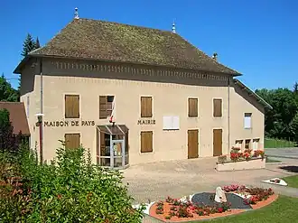 The town hall of Charavines | |
Location of Charavines | |
 Charavines  Charavines | |
| Coordinates: 45°25′54″N 5°30′51″E / 45.4317°N 5.5142°E | |
| Country | France |
| Region | Auvergne-Rhône-Alpes |
| Department | Isère |
| Arrondissement | La Tour-du-Pin |
| Canton | Le Grand-Lemps |
| Intercommunality | CA Pays Voironnais |
| Government | |
| • Mayor (2020–2026) | Bruno Guillaud-Bataille[1] |
Area 1 | 7.52 km2 (2.90 sq mi) |
| Population (2022)[2] | 2,014 |
| • Density | 270/km2 (690/sq mi) |
| Time zone | UTC+01:00 (CET) |
| • Summer (DST) | UTC+02:00 (CEST) |
| INSEE/Postal code | 38082 /38850 |
| Elevation | 440–800 m (1,440–2,620 ft) (avg. 516 m or 1,693 ft) |
| 1 French Land Register data, which excludes lakes, ponds, glaciers > 1 km2 (0.386 sq mi or 247 acres) and river estuaries. | |
Charavines (French pronunciation: [ʃaʁavin]) is a commune in the Isère department in southeastern France.
Population
| Year | Pop. | ±% p.a. |
|---|---|---|
| 1968 | 1,250 | — |
| 1975 | 1,142 | −1.28% |
| 1982 | 1,163 | +0.26% |
| 1990 | 1,251 | +0.92% |
| 1999 | 1,423 | +1.44% |
| 2007 | 1,701 | +2.26% |
| 2012 | 1,823 | +1.39% |
| 2017 | 1,925 | +1.09% |
| Source: INSEE[3] | ||
See also
References
- ^ "Répertoire national des élus: les maires". data.gouv.fr, Plateforme ouverte des données publiques françaises (in French). 2 December 2020.
- ^ "Populations de référence 2022" (in French). The National Institute of Statistics and Economic Studies. 19 December 2024.
- ^ Population en historique depuis 1968, INSEE
Wikimedia Commons has media related to Charavines.