Crachier
Crachier | |
|---|---|
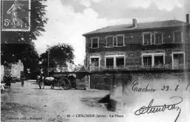 Crachier in 1908 | |
Location of Crachier | |
 Crachier  Crachier | |
| Coordinates: 45°32′57″N 5°13′35″E / 45.5492°N 5.2264°E | |
| Country | France |
| Region | Auvergne-Rhône-Alpes |
| Department | Isère |
| Arrondissement | La Tour-du-Pin |
| Canton | L'Isle-d'Abeau |
| Intercommunality | CA Porte de l'Isère |
| Government | |
| • Mayor (2020–2026) | Nadine Roy[1] |
Area 1 | 3.64 km2 (1.41 sq mi) |
| Population (2022)[2] | 590 |
| • Density | 160/km2 (420/sq mi) |
| Time zone | UTC+01:00 (CET) |
| • Summer (DST) | UTC+02:00 (CEST) |
| INSEE/Postal code | 38136 /38300 |
| Elevation | 370–462 m (1,214–1,516 ft) |
| 1 French Land Register data, which excludes lakes, ponds, glaciers > 1 km2 (0.386 sq mi or 247 acres) and river estuaries. | |
Crachier (French pronunciation: [kʁaʃje]) is a commune in the Isère department in southeastern France.
Population
| Year | Pop. | ±% p.a. |
|---|---|---|
| 1968 | 208 | — |
| 1975 | 258 | +3.13% |
| 1982 | 286 | +1.48% |
| 1990 | 334 | +1.96% |
| 1999 | 432 | +2.90% |
| 2007 | 458 | +0.73% |
| 2012 | 474 | +0.69% |
| 2017 | 508 | +1.40% |
| Source: INSEE[3] | ||
See also
References
- ^ "Répertoire national des élus: les maires". data.gouv.fr, Plateforme ouverte des données publiques françaises (in French). 2 December 2020.
- ^ "Populations de référence 2022" (in French). The National Institute of Statistics and Economic Studies. 19 December 2024.
- ^ Population en historique depuis 1968, INSEE
Wikimedia Commons has media related to Crachier.