Lafarre, Ardèche
Lafarre | |
|---|---|
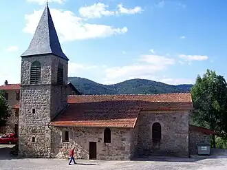 The church in Lafarre | |
Location of Lafarre | |
 Lafarre  Lafarre | |
| Coordinates: 45°04′49″N 4°30′37″E / 45.0803°N 4.5103°E | |
| Country | France |
| Region | Auvergne-Rhône-Alpes |
| Department | Ardèche |
| Arrondissement | Tournon-sur-Rhône |
| Canton | Haut-Vivarais |
| Government | |
| • Mayor (2020–2026) | Stéphane Roche[1] |
Area 1 | 11.33 km2 (4.37 sq mi) |
| Population (2022)[2] | 45 |
| • Density | 4.0/km2 (10/sq mi) |
| Time zone | UTC+01:00 (CET) |
| • Summer (DST) | UTC+02:00 (CEST) |
| INSEE/Postal code | 07124 /07520 |
| Elevation | 540–1,183 m (1,772–3,881 ft) (avg. 720 m or 2,360 ft) |
| 1 French Land Register data, which excludes lakes, ponds, glaciers > 1 km2 (0.386 sq mi or 247 acres) and river estuaries. | |
Lafarre (French pronunciation: [lafaʁ]; Occitan: La Fara) is a commune in the Ardèche department in southern France.
Population
| Year | Pop. | ±% |
|---|---|---|
| 1962 | 184 | — |
| 1968 | 111 | −39.7% |
| 1975 | 74 | −33.3% |
| 1982 | 70 | −5.4% |
| 1990 | 60 | −14.3% |
| 1999 | 57 | −5.0% |
| 2008 | 42 | −26.3% |
See also
References
- ^ "Répertoire national des élus: les maires". data.gouv.fr, Plateforme ouverte des données publiques françaises (in French). 9 August 2021.
- ^ "Populations de référence 2022" (in French). The National Institute of Statistics and Economic Studies. 19 December 2024.
Wikimedia Commons has media related to Lafarre, Ardèche.