Le Pradal
Le Pradal | |
|---|---|
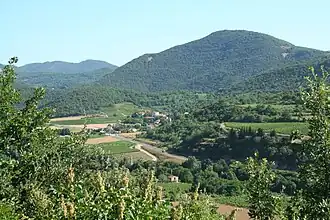 The landscape of Le Pradal | |
.svg.png) Coat of arms | |
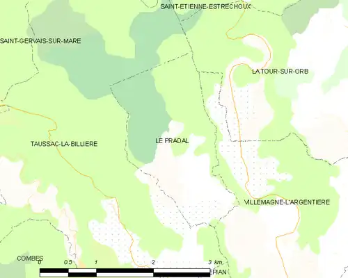
Location of Le Pradal | |
 Le Pradal  Le Pradal | |
| Coordinates: 43°37′42″N 3°06′18″E / 43.6283°N 3.105°E | |
| Country | France |
| Region | Occitania |
| Department | Hérault |
| Arrondissement | Béziers |
| Canton | Clermont-l'Hérault |
| Government | |
| • Mayor (2020–2026) | Christian Biés[1] |
Area 1 | 3.8 km2 (1.5 sq mi) |
| Population (2022)[2] | 325 |
| • Density | 86/km2 (220/sq mi) |
| Time zone | UTC+01:00 (CET) |
| • Summer (DST) | UTC+02:00 (CEST) |
| INSEE/Postal code | 34216 /34600 |
| Elevation | 236–662 m (774–2,172 ft) (avg. 272 m or 892 ft) |
| 1 French Land Register data, which excludes lakes, ponds, glaciers > 1 km2 (0.386 sq mi or 247 acres) and river estuaries. | |
Le Pradal (French pronunciation: [lə pʁadal]; Occitan: Lo Pradal) is a commune in the Hérault department in the Occitanie region in southern France.
Population
| Year | Pop. | ±% |
|---|---|---|
| 1962 | 101 | — |
| 1968 | 101 | +0.0% |
| 1975 | 97 | −4.0% |
| 1982 | 136 | +40.2% |
| 1990 | 178 | +30.9% |
| 1999 | 191 | +7.3% |
| 2008 | 265 | +38.7% |
See also
References
- ^ "Répertoire national des élus: les maires" (in French). data.gouv.fr, Plateforme ouverte des données publiques françaises. 13 September 2022.
- ^ "Populations de référence 2022" (in French). The National Institute of Statistics and Economic Studies. 19 December 2024.
Wikimedia Commons has media related to Le Pradal.