Saint-Mathieu-de-Tréviers
Saint-Mathieu-de-Tréviers | |
|---|---|
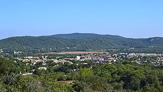 A general view of Saint-Mathieu-de-Tréviers | |
.svg.png) Coat of arms | |
Location of Saint-Mathieu-de-Tréviers | |
 Saint-Mathieu-de-Tréviers  Saint-Mathieu-de-Tréviers | |
| Coordinates: 43°46′14″N 3°52′10″E / 43.7706°N 3.8694°E | |
| Country | France |
| Region | Occitania |
| Department | Hérault |
| Arrondissement | Lodève |
| Canton | Saint-Gély-du-Fesc |
| Intercommunality | Grand Pic Saint-Loup |
| Government | |
| • Mayor (2020–2026) | Jerôme Lopez[1] |
Area 1 | 21.92 km2 (8.46 sq mi) |
| Population (2022)[2] | 4,869 |
| • Density | 220/km2 (580/sq mi) |
| Time zone | UTC+01:00 (CET) |
| • Summer (DST) | UTC+02:00 (CEST) |
| INSEE/Postal code | 34276 /34270 |
| Elevation | 78–400 m (256–1,312 ft) (avg. 81 m or 266 ft) |
| 1 French Land Register data, which excludes lakes, ponds, glaciers > 1 km2 (0.386 sq mi or 247 acres) and river estuaries. | |
Saint-Mathieu-de-Tréviers (French pronunciation: [sɛ̃ matjø də tʁevje]; Occitan: Sant Matieu de Trevièrs) is a commune in the Hérault department in the Occitanie region in southern France.
Population
| Year | Pop. | ±% p.a. |
|---|---|---|
| 1968 | 571 | — |
| 1975 | 954 | +7.61% |
| 1982 | 1,505 | +6.73% |
| 1990 | 2,623 | +7.19% |
| 1999 | 3,713 | +3.94% |
| 2007 | 4,659 | +2.88% |
| 2012 | 4,665 | +0.03% |
| 2017 | 4,790 | +0.53% |
| Source: INSEE[3] | ||
See also
References
- ^ "Répertoire national des élus: les maires" (in French). data.gouv.fr, Plateforme ouverte des données publiques françaises. 13 September 2022.
- ^ "Populations de référence 2022" (in French). The National Institute of Statistics and Economic Studies. 19 December 2024.
- ^ Population en historique depuis 1968, INSEE
Wikimedia Commons has media related to Saint-Mathieu-de-Tréviers.