Saint-Bauzille-de-Putois
Saint-Bauzille-de-Putois | |
|---|---|
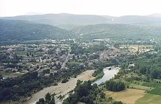 An aerial view of Saint-Bauzille-de-Putois | |
.svg.png) Coat of arms | |
Location of Saint-Bauzille-de-Putois | |
 Saint-Bauzille-de-Putois  Saint-Bauzille-de-Putois | |
| Coordinates: 43°53′46″N 3°44′13″E / 43.8961°N 3.7369°E | |
| Country | France |
| Region | Occitania |
| Department | Hérault |
| Arrondissement | Lodève |
| Canton | Lodève |
| Intercommunality | Cévennes Gangeoises et Suménoises |
| Government | |
| • Mayor (2020–2026) | Oscar Alle[1] |
Area 1 | 18.16 km2 (7.01 sq mi) |
| Population (2022)[2] | 1,839 |
| • Density | 100/km2 (260/sq mi) |
| Time zone | UTC+01:00 (CET) |
| • Summer (DST) | UTC+02:00 (CEST) |
| INSEE/Postal code | 34243 /34190 |
| Elevation | 118–483 m (387–1,585 ft) (avg. 137 m or 449 ft) |
| 1 French Land Register data, which excludes lakes, ponds, glaciers > 1 km2 (0.386 sq mi or 247 acres) and river estuaries. | |
Saint-Bauzille-de-Putois (French pronunciation: [sɛ̃ bozil də pytwa]; Occitan: Sent Bausèli de Fouine) is a commune in the Hérault department in the Occitanie region in southern France.
Population
| Year | Pop. | ±% p.a. |
|---|---|---|
| 1968 | 1,341 | — |
| 1975 | 1,186 | −1.74% |
| 1982 | 1,108 | −0.97% |
| 1990 | 1,021 | −1.02% |
| 1999 | 1,140 | +1.23% |
| 2007 | 1,385 | +2.46% |
| 2012 | 1,809 | +5.49% |
| 2017 | 1,977 | +1.79% |
| Source: INSEE[3] | ||
See also
References
- ^ "Répertoire national des élus: les maires". data.gouv.fr, Plateforme ouverte des données publiques françaises (in French). 9 August 2021.
- ^ "Populations de référence 2022" (in French). The National Institute of Statistics and Economic Studies. 19 December 2024.
- ^ Population en historique depuis 1968 (in French), INSEE.
Wikimedia Commons has media related to Saint-Bauzille-de-Putois.