Les Ressuintes
Les Ressuintes | |
|---|---|
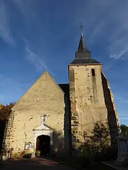 The church in Les Ressuintes | |
Location of Les Ressuintes | |
 Les Ressuintes  Les Ressuintes | |
| Coordinates: 48°36′21″N 0°56′19″E / 48.6059°N 0.9386°E | |
| Country | France |
| Region | Centre-Val de Loire |
| Department | Eure-et-Loir |
| Arrondissement | Dreux |
| Canton | Saint-Lubin-des-Joncherets |
| Intercommunality | Forêts du Perche |
| Government | |
| • Mayor (2020–2026) | Kristell Chevreau[1] |
Area 1 | 7.46 km2 (2.88 sq mi) |
| Population (2022)[2] | 153 |
| • Density | 21/km2 (53/sq mi) |
| Time zone | UTC+01:00 (CET) |
| • Summer (DST) | UTC+02:00 (CEST) |
| INSEE/Postal code | 28314 /28340 |
| Elevation | 224–281 m (735–922 ft) (avg. 242 m or 794 ft) |
| 1 French Land Register data, which excludes lakes, ponds, glaciers > 1 km2 (0.386 sq mi or 247 acres) and river estuaries. | |
Les Ressuintes is a commune in the Eure-et-Loir department in northern France.
Geography
The Commune along with another 70 communes shares part of a 47,681 hectare, Natura 2000 conservation area, called the Forêts et étangs du Perche.[3]
Population
| Year | Pop. | ±% |
|---|---|---|
| 1962 | 67 | — |
| 1968 | 115 | +71.6% |
| 1975 | 100 | −13.0% |
| 1982 | 101 | +1.0% |
| 1990 | 79 | −21.8% |
| 1999 | 127 | +60.8% |
| 2008 | 151 | +18.9% |
See also
References
- ^ "Répertoire national des élus: les maires". data.gouv.fr, Plateforme ouverte des données publiques françaises (in French). 9 August 2021.
- ^ "Populations de référence 2022" (in French). The National Institute of Statistics and Economic Studies. 19 December 2024.
- ^ "INPN - FSD Natura 2000 - FR2512004 - Forêts et étangs du Perche - Description".
Wikimedia Commons has media related to Les Ressuintes.