Luigny
Luigny | |
|---|---|
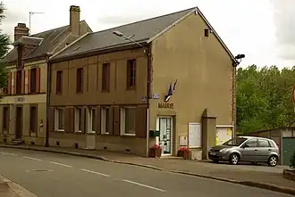 Town hall | |
 Coat of arms | |
Location of Luigny | |
 Luigny  Luigny | |
| Coordinates: 48°14′30″N 1°01′27″E / 48.2417°N 1.0242°E | |
| Country | France |
| Region | Centre-Val de Loire |
| Department | Eure-et-Loir |
| Arrondissement | Nogent-le-Rotrou |
| Canton | Brou |
| Intercommunality | Perche |
| Government | |
| • Mayor (2020–2026) | Thierry Bouthier[1] |
Area 1 | 15.88 km2 (6.13 sq mi) |
| Population (2022)[2] | 423 |
| • Density | 27/km2 (69/sq mi) |
| Time zone | UTC+01:00 (CET) |
| • Summer (DST) | UTC+02:00 (CEST) |
| INSEE/Postal code | 28219 /28480 |
| Elevation | 173–257 m (568–843 ft) (avg. 190 m or 620 ft) |
| 1 French Land Register data, which excludes lakes, ponds, glaciers > 1 km2 (0.386 sq mi or 247 acres) and river estuaries. | |
Luigny (French pronunciation: [lɥiɲi]) is a commune in the Eure-et-Loir department in northern France.
Population
| Year | Pop. | ±% |
|---|---|---|
| 1962 | 415 | — |
| 1968 | 446 | +7.5% |
| 1975 | 441 | −1.1% |
| 1982 | 347 | −21.3% |
| 1990 | 342 | −1.4% |
| 1999 | 376 | +9.9% |
| 2008 | 407 | +8.2% |
See also
References
- ^ "Répertoire national des élus: les maires". data.gouv.fr, Plateforme ouverte des données publiques françaises (in French). 9 August 2021.
- ^ "Populations de référence 2022" (in French). The National Institute of Statistics and Economic Studies. 19 December 2024.
Wikimedia Commons has media related to Luigny.