Méréglise
Méréglise | |
|---|---|
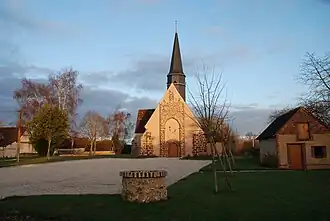 The church in Méréglise | |
Location of Méréglise | |
 Méréglise  Méréglise | |
| Coordinates: 48°17′27″N 1°11′10″E / 48.2908°N 1.1861°E | |
| Country | France |
| Region | Centre-Val de Loire |
| Department | Eure-et-Loir |
| Arrondissement | Chartres |
| Canton | Illiers-Combray |
| Government | |
| • Mayor (2020–2026) | Gérard Huet[1] |
Area 1 | 4 km2 (2 sq mi) |
| Population (2022)[2] | 106 |
| • Density | 27/km2 (69/sq mi) |
| Time zone | UTC+01:00 (CET) |
| • Summer (DST) | UTC+02:00 (CEST) |
| INSEE/Postal code | 28242 /28120 |
| Elevation | 155–183 m (509–600 ft) (avg. 120 m or 390 ft) |
| 1 French Land Register data, which excludes lakes, ponds, glaciers > 1 km2 (0.386 sq mi or 247 acres) and river estuaries. | |
Méréglise (French pronunciation: [meʁeɡliz]) is a commune in the Eure-et-Loir department in northern France.
Population
| Year | Pop. | ±% p.a. |
|---|---|---|
| 1968 | 85 | — |
| 1975 | 67 | −3.34% |
| 1982 | 65 | −0.43% |
| 1990 | 74 | +1.63% |
| 1999 | 70 | −0.62% |
| 2009 | 93 | +2.88% |
| 2014 | 103 | +2.06% |
| 2020 | 101 | −0.33% |
| Source: INSEE[3] | ||
See also
References
- ^ "Répertoire national des élus: les maires". data.gouv.fr, Plateforme ouverte des données publiques françaises (in French). 2 December 2020.
- ^ "Populations de référence 2022" (in French). The National Institute of Statistics and Economic Studies. 19 December 2024.
- ^ Population en historique depuis 1968, INSEE
Wikimedia Commons has media related to Méréglise.