Ochtezeele
Ochtezeele
Ochtezele | |
|---|---|
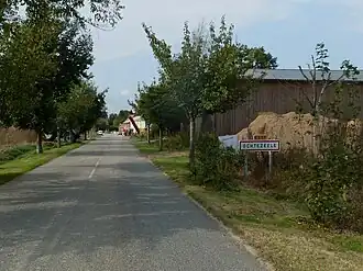 The road into Ochtezeele | |
Location of Ochtezeele | |
 Ochtezeele  Ochtezeele | |
| Coordinates: 50°49′04″N 2°24′10″E / 50.8178°N 2.4028°E | |
| Country | France |
| Region | Hauts-de-France |
| Department | Nord |
| Arrondissement | Dunkerque |
| Canton | Wormhout |
| Intercommunality | CA Cœur de Flandre |
| Government | |
| • Mayor (2022–2026) | Joël Vermeulen[1] |
Area 1 | 5.58 km2 (2.15 sq mi) |
| Population (2022)[2] | 363 |
| • Density | 65/km2 (170/sq mi) |
| Demonym | Ochtezeelois (es) |
| Time zone | UTC+01:00 (CET) |
| • Summer (DST) | UTC+02:00 (CEST) |
| INSEE/Postal code | 59443 /59670 |
| Elevation | 19–62 m (62–203 ft) (avg. 24 m or 79 ft) |
| 1 French Land Register data, which excludes lakes, ponds, glaciers > 1 km2 (0.386 sq mi or 247 acres) and river estuaries. | |
Ochtezeele (French pronunciation: [ɔktəzɛl]; from Flemish; Ochtezele in modern Dutch spelling) is a commune in the Nord department in northern France.[3]
The small river Peene Becque flows through the village.
Heraldry
_Nord-France.svg.png) |
The arms of Ochtezeele are blazoned : Azure, a bend argent. (Bouvignies, Jolimetz and use the same arms.)
|
See also
References
- ^ "Répertoire national des élus: les maires" (in French). data.gouv.fr, Plateforme ouverte des données publiques françaises. 13 September 2022.
- ^ "Populations de référence 2022" (in French). The National Institute of Statistics and Economic Studies. 19 December 2024.
- ^ INSEE commune file
Wikimedia Commons has media related to Ochtezeele.