Volckerinckhove
Volckerinckhove | |
|---|---|
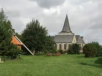 The church in Volckerinckhove | |
.svg.png) Coat of arms | |
Location of Volckerinckhove | |
 Volckerinckhove  Volckerinckhove | |
| Coordinates: 50°50′22″N 2°18′23″E / 50.8394°N 2.3064°E | |
| Country | France |
| Region | Hauts-de-France |
| Department | Nord |
| Arrondissement | Dunkirk |
| Canton | Wormhout |
| Intercommunality | Hauts de Flandre |
| Government | |
| • Mayor (2022–2026) | Nathalie Beun[1] |
Area 1 | 9.88 km2 (3.81 sq mi) |
| Population (2022)[2] | 567 |
| • Density | 57/km2 (150/sq mi) |
| Demonym | Volckerinckhovois |
| Time zone | UTC+01:00 (CET) |
| • Summer (DST) | UTC+02:00 (CEST) |
| INSEE/Postal code | 59628 /59470 |
| Elevation | 15–61 m (49–200 ft) (avg. 30 m or 98 ft) |
| 1 French Land Register data, which excludes lakes, ponds, glaciers > 1 km2 (0.386 sq mi or 247 acres) and river estuaries. | |
Volckerinckhove (French pronunciation: [vɔlkəʁɛ̃kɔv]; Dutch: Volkerinkhove) is a commune in the Nord department in northern France. It is part of the arrondissement of Dunkirk and the canton of Wormhout.[3]
Heraldry
|
The arms of Volckerinckhove are blazoned : Sable, on a chief argent, 2 mullets of 6 points pierced gules.
|
See also
References
- ^ "Répertoire national des élus: les maires" (in French). data.gouv.fr, Plateforme ouverte des données publiques françaises. 6 June 2023.
- ^ "Populations de référence 2022" (in French). The National Institute of Statistics and Economic Studies. 19 December 2024.
- ^ INSEE commune file
Wikimedia Commons has media related to Volckerinckhove.