Rubrouck
Rubrouck | |
|---|---|
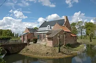 The presbytery in Rubrouck | |
_Nord-France.svg.png) Coat of arms | |
Location of Rubrouck | |
 Rubrouck  Rubrouck | |
| Coordinates: 50°50′22″N 2°21′23″E / 50.8394°N 2.3564°E | |
| Country | France |
| Region | Hauts-de-France |
| Department | Nord |
| Arrondissement | Dunkerque |
| Canton | Wormhout |
| Intercommunality | CA Cœur de Flandre |
| Government | |
| • Mayor (2020–2026) | Luc Everaere[1] |
Area 1 | 14.88 km2 (5.75 sq mi) |
| Population (2022)[2] | 915 |
| • Density | 61/km2 (160/sq mi) |
| Demonym | Rubrouckois |
| Time zone | UTC+01:00 (CET) |
| • Summer (DST) | UTC+02:00 (CEST) |
| INSEE/Postal code | 59516 /59285 |
| Elevation | 20–65 m (66–213 ft) (avg. 33 m or 108 ft) |
| 1 French Land Register data, which excludes lakes, ponds, glaciers > 1 km2 (0.386 sq mi or 247 acres) and river estuaries. | |
Rubrouck (French pronunciation: [ʁybʁuk]; Dutch: Rubroek, once Ruysbroeck) is a commune in the Nord department in northern France.[3]
History
Rubrouck was first mentioned in 1104. It was the home of the 13th century explorer William of Rubruck (fl.1248–1255).[4]
Heraldry
|
The arms of Rubrouck are blazoned : Gules, a lion argent armed and langued Or. (Broxeele and use the same arms.)
|
See also
References
- ^ "Répertoire national des élus: les maires". data.gouv.fr, Plateforme ouverte des données publiques françaises (in French). 2 December 2020.
- ^ "Populations de référence 2022" (in French). The National Institute of Statistics and Economic Studies. 19 December 2024.
- ^ INSEE commune file
- ^ Yule, Henry; Beazley, Charles Raymond (1911). . Encyclopædia Britannica. Vol. 23 (11th ed.). pp. 810–812.
Wikimedia Commons has media related to Rubrouck.