Úlehle
Úlehle | |
|---|---|
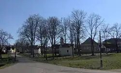 Radkovice, a part of Úlehle | |
 Úlehle Location in the Czech Republic | |
| Coordinates: 49°12′6″N 13°50′18″E / 49.20167°N 13.83833°E | |
| Country | |
| Region | South Bohemian |
| District | Strakonice |
| First mentioned | 1318 |
| Area | |
• Total | 6.56 km2 (2.53 sq mi) |
| Elevation | 513 m (1,683 ft) |
| Population (2025-01-01)[1] | |
• Total | 90 |
| • Density | 14/km2 (36/sq mi) |
| Time zone | UTC+1 (CET) |
| • Summer (DST) | UTC+2 (CEST) |
| Postal codes | 386 01, 387 19 |
| Website | www |
Úlehle is a municipality and village in Strakonice District in the South Bohemian Region of the Czech Republic. It has about 90 inhabitants.
Úlehle lies approximately 8 kilometres (5 mi) south-west of Strakonice, 53 km (33 mi) north-west of České Budějovice, and 107 km (66 mi) south-west of Prague.
Administrative division
Úlehle consists of three municipal parts (in brackets population according to the 2021 census):[2]
- Úlehle (46)
- Radkovice (34)
- Švejcarova Lhota (18)
Demographics
| Year | Pop. | ±% |
|---|---|---|
| 1869 | 380 | — |
| 1880 | 359 | −5.5% |
| 1890 | 337 | −6.1% |
| 1900 | 366 | +8.6% |
| 1910 | 359 | −1.9% |
| 1921 | 377 | +5.0% |
| 1930 | 353 | −6.4% |
| 1950 | 270 | −23.5% |
| 1961 | 245 | −9.3% |
| 1970 | 213 | −13.1% |
| 1980 | 187 | −12.2% |
| 1991 | 130 | −30.5% |
| 2001 | 126 | −3.1% |
| 2011 | 100 | −20.6% |
| 2021 | 98 | −2.0% |
| Source: Censuses[3][4] | ||
References
- ^ "Population of Municipalities – 1 January 2025". Czech Statistical Office. 2025-05-16.
- ^ "Public Census 2021 – basic data". Public Database (in Czech). Czech Statistical Office. 2022.
- ^ "Historický lexikon obcí České republiky 1869–2011" (in Czech). Czech Statistical Office. 2015-12-21.
- ^ "Population Census 2021: Population by sex". Public Database. Czech Statistical Office. 2021-03-27.
External links
Wikimedia Commons has media related to Úlehle.