Cehnice
Cehnice | |
|---|---|
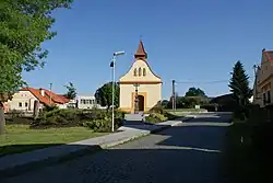 Chapel in the centre of Cehnice | |
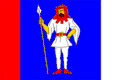 Flag 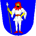 Coat of arms | |
 Cehnice Location in the Czech Republic | |
| Coordinates: 49°12′55″N 14°1′46″E / 49.21528°N 14.02944°E | |
| Country | |
| Region | South Bohemian |
| District | Strakonice |
| First mentioned | 1342 |
| Area | |
• Total | 14.69 km2 (5.67 sq mi) |
| Elevation | 432 m (1,417 ft) |
| Population (2025-01-01)[1] | |
• Total | 511 |
| • Density | 35/km2 (90/sq mi) |
| Time zone | UTC+1 (CET) |
| • Summer (DST) | UTC+2 (CEST) |
| Postal code | 387 52 |
| Website | www |
Cehnice is a municipality and village in Strakonice District in the South Bohemian Region of the Czech Republic. It has about 500 inhabitants.
Cehnice lies approximately 11 kilometres (7 mi) south-east of Strakonice, 43 km (27 mi) north-west of České Budějovice, and 101 km (63 mi) south of Prague.
Administrative division
Cehnice consists of two municipal parts (in brackets population according to the 2021 census):[2]
- Cehnice (451)
- Dunovice (65)
Demographics
| Year | Pop. | ±% |
|---|---|---|
| 1869 | 1,012 | — |
| 1880 | 1,030 | +1.8% |
| 1890 | 1,004 | −2.5% |
| 1900 | 953 | −5.1% |
| 1910 | 892 | −6.4% |
| 1921 | 931 | +4.4% |
| 1930 | 840 | −9.8% |
| 1950 | 651 | −22.5% |
| 1961 | 649 | −0.3% |
| 1970 | 592 | −8.8% |
| 1980 | 561 | −5.2% |
| 1991 | 520 | −7.3% |
| 2001 | 438 | −15.8% |
| 2011 | 473 | +8.0% |
| 2021 | 516 | +9.1% |
| Source: Censuses[3][4] | ||
References
- ^ "Population of Municipalities – 1 January 2025". Czech Statistical Office. 2025-05-16.
- ^ "Public Census 2021 – basic data". Public Database (in Czech). Czech Statistical Office. 2022.
- ^ "Historický lexikon obcí České republiky 1869–2011" (in Czech). Czech Statistical Office. 2015-12-21.
- ^ "Population Census 2021: Population by sex". Public Database. Czech Statistical Office. 2021-03-27.
External links
Wikimedia Commons has media related to Cehnice.